Community Management

12Apr

On being a HOT Board Member

After 4 years, today my last day as a Board Member of Humanitarian OpenStreetMap Team. We have annual board elections announced at our Annual General Meeting in a few short hours. During my time on HOT’s Board, I served as a Member-at-Large, Secretary and President. Serving on the HOT board has been challenging and rewarding as the NGO has grown in leaps and bounds. It has been an honour to be part of that journey with fellow board members, members, staff, community allies, donors, and supporters. (Thank you.)

The Humanitarian OpenStreetMap Team (HOT) applies the principles of open source and open data sharing for humanitarian response and economic development.

Being a Board Member for a small NGO can be a serious commitment. HOT’s Board is transitioning from operations to a strategic board. It is something that every open source community does over time. To support this change, the board, staff and membership have learned much about organizational development, governance and fundraising. This has taken substantial leadership from two Executive Directors (Kate Chapman and Tyler Radford), staff, and many fellow Board Members. Some of the ‘back office support’ that the HOT board provided previously are now staff and community roles. (One example of organizational development, is the Board Primer that I curated.)

Honestly, serving HOT changed my life and I am thankful for all the experiences. And, I am thankful for all the amazing people with whom I met or collaborated.

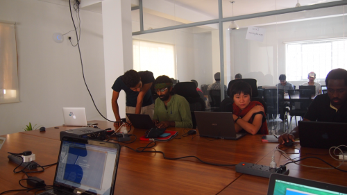
HOT Activation Sprint

What being on the Board taught me

We all have our goals – personal and career.

Being on the HOT Board taught me to be a better leader. There are so many proud moments as I reflect – watching and supporting leaders, learning about all the amazing projects and advocacy work, and sharing the HOT story in many public forums, like this Datashift article. I helped build and support a growing NGO. HOT truly inspires me, as do the staff, partners and extended community. The skills I learned have helped my career – organizational development, strategic planning, meeting management, co-writing grants, interviewing staff, hiring an Executive Director, communications planning, and planning a strategic board meeting.

Other skills that I learned and/or honed: negotiation skills, coordination, dealing with conflict, managing people, and mentorship. Everyone’s Board Member path is different. If you are considering running for a board and/or joining a Board, I am available to talk.

I remain an active member of HOT, including co-leading our Governance Working Group.

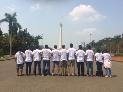
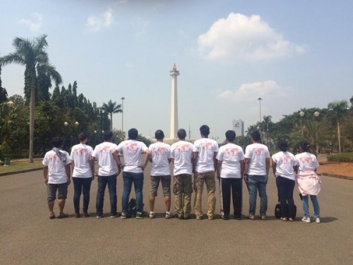
(Photo credit: Jakarta HOT Activation Workshop, ccby by Mhairi O’Hara)

Thank you and keep on inspiring,

11Nov

Data @ IFRC #4: GO Project, Malawi Red Cross

[ed. note: Data @ IFRC is a blog series to share highlights from data-driven Red Cross Red Crescent national societies, learning opportunities and thought pieces on all things data from ethics to evidence.]

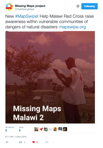
Malawi Red Cross MapSwipe 2

Help the Malawi Red Cross

A few clicks and taps could help the Malawi Red Cross with their humanitarian efforts. Games for change in the humanitarian space are growing. The Malawi Red Cross and Netherlands Red Cross have a programme needs your help.
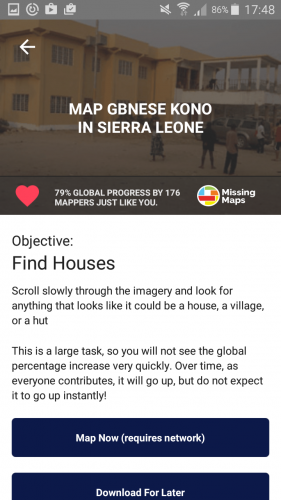
MapSwipe is a gamefied mobile app developed for the Missing Maps Project to enable fast satellite image classification on mobile devices. It is a game that allows anyone to quickly make decisions about which items have roads and/or buildings in the images. These ‘tagged’ images are then sorted to have mappers at Missing Mapathons add the details into OpenStreetMap. Then, the data is used for local programmes like delivering health needs and logistics. The new mission on #MapSwipe for the Malawi Red Cross / Netherlands Red Cross collaboration to raise awareness within vulnerable communities in disaster prone areas of the possible dangers of natural disasters.

GET MAPSWIPE: The easy to use MapSwipe app can be used on android and iphone devices.

ABOUT Missing Maps – Learn more about MapSwipe and Missing Maps on Facebook.

Go with Data

This week we are sprinting on the GO Project – this is a humanitarian emergency data project to support responders in the Federation. IFRC aims to be a data-driven organization based on evidence based decisions. We provide current IFRC datasets, Red Cross Red Crescent datasets, links to other humanitarian resources and data learning materials. The team is envisioning the next steps to get from prototype to implementation. All the code is online.

GO Team sprinting

Teach Around the Data

Clearly expecting people to simply become data ready or a data scientist is unrealistic. So, while we build tools, training and programmes it is key to focus on the ecosystem around data literacy. From
Emmanuel Letouzé, Director and co-Founder, Data-Pop Alliance; Visiting Scholar, MIT Media Lab:

“I am arguing that the current focus on data literacy is an opportunity, reflecting back on the nature and role of literacy in history, to promote and foster a consequentialist, broader and thicker, conceptualization of data literacy as literacy in the age of data, one that will allow citizens and societies to challenge current power structures and dynamics to meet their goals, and perhaps the Sustainable Development Goals.”

Alright, so we build!

Building community around data training

Atlassian site
One of the items that I am keen to build is a Data playbook to serve the diverse communities within the IFRC and National Societies. The existing leaders are creating materials and we are connecting on how to share widely.

A playbook is a document and/or website that is an editable place with recipes, best practices, and technology. There are many styles and methods to build this type of project. Atlassian just launched a new Playbook which truly rocks with easy to use methods to build digital teams. It is inspiring to consider how we can create data literacy guides like this. (source:”Did Atlassian just crack the code on digital teamwork“.)

18Aug

Co-creating and Celebrating Humanitarian OpenStreetMap Team

Maps connect us and tell stories. On Thursday, September 22, 2016, the Humanitarian OpenStreetMap Team will convene for our 2nd annual HOT Summit in Brussels on the eve of the State of the Map conference. Both events celebrate OpenStreetMap and the community.

HOT Summit Logo

Top 5 Reasons to be at the HOT Summit

1. Leaders will share their map stories from around the globe

Check out the amazing programme of speakers from Indonesia, Canada, US, Tanzania and more.
HOT activation traininng in Jakarta

(Photo by Mhairi O’hara at the HOT Activation Workshop, Jakarta 2015)

2. Meet and build HOT and OSM together

The map is bigger than one individual. It is a community, a network of networks.

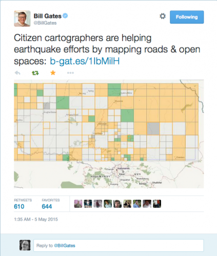
Bill Gates on OSM in Nepal Response May 5, 2015

3. Provide input into HOT’s future strategic planning

We are 6 year’s young and so much to do. Give us advice, take a task, share your experience, express your opinion. We will have many conversations and coffee conversations about the future of HOT. Help us co-create this strategy.

Road by BraveBros. from the Noun Project noun_106568_cc

(Image credit- Road by BraveBros. from the Noun Project)

4. Learn new skills from peers

The talent in this community to teach each other is amazing. Having an in person space to learn, ask questions, grab a side table to map makes the HOT Summit a space for everyone. Just ask. I am sure that we will find someone who can answer your questions or even learn a thing or two from you!

Mapping Nepal (photo by Gopinath Parayil))

(Photo for the Nepal Earthquake response by Gopinath Parayil)

5. Have fun mapping for change with your new friends

A few of the HOT community attended the World Humanitarian Summit. Many of us had not met before in person. Times of laughter and solidarity make all the difference.
HOT at WHS 2016

(photo for WHS 2016 using Heather’s phone)

Why join us?

How can we get to the next million participants creating the largest open map? How can improve everyone’s experience from novice to advanced? What are some of the project highlights from around the world?

Achieving our mission to help humanitarians and economic development with OpenStreetMap means widening the circle. Sure, we will talk fine details about mapping, but there is space for everyone to explore and contribute. Even if you are not a ‘mapper’, but are curious about open source and open mapping, then join us. We aim to improve the map and grow the global community. Over the past months, our team has been demonstrating how HOT can help achieve the Sustainable Development Goals and help humanitarians with Missing Maps. This action packed day has tickets available for 66.24Euro. (Register today!)

15Jul

You can MapSwipe!

Every day we use our phones. We tap, we read, we photograph, we chat, we view, and we connect. But wait! What if your ‘tapping’ time could help a humanitarian? Queue MapSwipe.

mapswipe_lockup_whiteblue larger

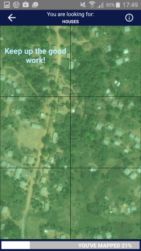
Your quick tapping decisions about images could save mappers time and help the most vulnerable. Satellite imagery for project regions are added to MapSwipe. Then, we give you project tasks focused on looking for key items. For example some projects will look for houses, if you see a house in a tile, you tap once for yes (tile turns green), if you are unsure you tap twice (tile turns yellow) or if the tile is flawed (blurry), then you tap three times (tile turns red). Multiple people look at the tiles so that we can crowdsource to higher accuracy. Once the project is completed, we share the curated data with mappers who will review and map the data on OpenStreetMap. All of this is to help humanitarians have the best map possible.

MapSwipe main project screen “In a humanitarian crisis, the location of the most vulnerable people is fundamental information for delivering food, shelter, medical care and other services where they are most needed. And, although it may be hard to believe, millions people around the world are not represented on any accessible map.” (Pete Masters, Missing Maps Coordinator, MSF, July 14, 2016)

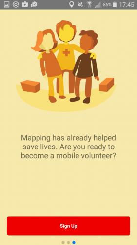
MapSwipe is available today on the Google Play and Itunes stores. Download and MapSwipe Today!

MapSwipe is a Missing Maps project aimed to proactively map the places in the world where the most vulnerable people live before a crisis happens. Missing Maps is a partnership between Medecins sans Frontieres, American Red Cross, British Red Cross, Netherlands Red Cross, CartoONG, and Humanitarian OpenStreetMap Team.

Please share MapSwipe widely with your friends and family. And, do let us know how we can improve. Help bit counts!

About MapSwipe Team and Project

MapSwipe was funded by MSF UK for the Missing Maps Project. Currently, all projects are for Missing Maps partners, but this might change in time. The tool was developed by an amazing team. Congratulations Ivan, Pim, Sadok, Alison, Pete, Astrid and Bennie. You all inspire me. (Note: My contribution of advisor was on my personal time as a proud Humanitarian OpenStreetMap Team Board Member. )

Imagery is provided by Bing (Thanks Microsoft!).

Thanks for Mapswipebe a mobile volunteer with mapswipe

26Jun

Conversation Starter

Feedback loops – we’re all talking about them in the ICT and Humanitarian spaces. What about globally? What about truly implementing these? The World Humanitarian Summit collective network outputs (reports, reviews and critiques) all point to this. The Sustainable Development Goals include goal 17 “Partnerships”. For a few years, I have been saying that we need to go to more coffee shops and community centers to get to the heart of the matter. Listening and conversation have become too abstract in the impact world. The strain on programmes becomes more and more evident. This is pervasive.

The global sway this weekend really caught many off guard, myself included. I’ve been devouring articles left, right and center. But have I? Living in the middle east gives me a unique filter for news from Europe and North America. For this I am thankful. There is a constant level of hard news about life in MENA and wartorn regions. Plus, every day I see workers outside in the heat or a train of staff walking behind people with arms full of babies or packages. Migration and the ebb of globalization is very much in the forefront of life in Qatar. Am I really listening? Are you?
coffee cup by Clockwise (noun project) noun_162033_cc

Lately I have been reading Chris Voss’s book on negotiation (Never Split the Difference). He writes clear crisp examples about why listening is key to affecting change for complex situations. The sense of humility and humanity in his words ring in my mind while all the other articles marinate. Including some of the latest articles by Umair Haque:

“We do not even love one another enough anymore to invest in simple things like transport, education, and healthcare. We deny one another the basics of life, and in that lack of compassion, respect, dignity, can only be found a profound chasm of love.” (Umair Haque, Love at the Edge of Time)

Well, I would say that there is a larger theme to address – we fail to actually have conversations anymore. For my age group, some call it the Facebook affect. We are talking past each other. Maybe it is the Pax (Serenity reference). This is part of why we are not getting things done. While this article is about building business networks, it speaks volumes about the state of play.

“If you want funders [Ed.note: insert stakeholder group] to go down the road with you, you need to make them feel: 1) smart, and 2) comfortable. Make that your mantra. Make it easy for them to grasp what you’re up to, and master your own anxiety so you don’t trigger it in them. We are talking about an encounter between good people who want the same things. A pitch turns it into an ordeal; a conversation makes it real. Choose the conversation.”
(Kevin Starr, The Pitch Is Dead. Long Live the Conversation.)

And, here is another spin on the same topic: “The War on Stupid“.

“We must stop glorifying intelligence and treating our society as a playground for the smart minority. We should instead begin shaping our economy, our schools, even our culture with an eye to the abilities and needs of the majority, and to the full range of human capacity. “

The world shifted just a bit more, but what are the next steps? If anything, this influences how I will work in my respective field. The silos we build are self-referential. Now, it is up to us to convince organizations, funders and other stakeholders that there is value in patience and really listening. Time for a cup of coffee with strangers.

(Image credit: Coffee cup by Clockwise (Noun Project))

13Apr

Crowdsourcing with Digital Responders

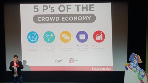
Crowdsourcing Global Week is in full swing in London, UK. Every aspect of Crowdsourcing is up for discussion. London is apparently one of the global leaders in Crowd Economy entrepreneurships. As I consider how we can reshape aid and really make a difference with digital humanitarians/digital responders, the lessons of those who have successful scaled communities and social entrepreneurship really resonate. When I consider their efforts to talk about the “5 Ps of the Crowd Economy”, I see that for our work in humanitarian and ICT we should simply replace “Platform” with “Programs & Partnerships” or “Project & Partnerships”.
4 P of crowd economy cswglobal16

There is so much potential to get people involved in their world using digital skills for good. As we observe those talking about the “crowd economy” and the “sharing economy”, we do need to consider how we can apply the lessons of our friends in the larger Crowdsourcing World. Today I will talk about what I think we need to build to connect global crowdsourcing and digital volunteers to existing programmes and communities. Volunteering is a gift and if we are going to scale Digital Responders then now is the time to link the various worlds. (There are extensive notes and resources in the slide notes.)

28Mar

Earth Observation Summer School

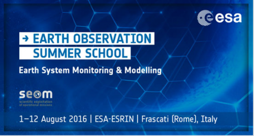
You can go to space….school! As 1 of 60 students at Earth Observation Summer School in Frascati (Rome), Italy, you will enjoy 2 weeks of learning and sharing.

The European Space Agency (ESA) is inviting young researchers to join leading experts in Earth Observation, Modelling and Data Assimilation for keynote lectures, hands-on computing practical and poster sessions on the occasion of the 8th ESA EO Summer School. I’m delighted to share about crowdsourcing, microtasking and building research programmes.

ESA Summer School

Applications are open until APRIL 6th, 2016.

The two-week course, held in ESA/ESRIN (near Rome, Italy) during August aims to provide students with an integrated end-to-end perspective going from measurement techniques to end-user applications. Courses include lectures covering issues related to Remote Sensing, Earth System Modelling and Data Assimilation as well as hands-on computing exercises on the processing of EO data. Students have the opportunity to present their work during a poster session. The three best posters will receive an award from the European Meteorological Society (EMS). Keynote lectures on global change issues are also given to discuss the current state of the science of global change and its relationship to society in order to help students appreciate how their specific field fits into a broader scientific and political context. For more information, please see previous programme, news or video.

Hope to see you there!

3Feb

Social Media and Humanitarian Response

[Ed. note: This is the full article submitted to the World Economic Forum report. Thanks to Shannon Dosemagen and Claire Wardle for their editorial guidance]

People use social media during emergencies. The speed and volume of online information is increasingly overwhelming to humanitarians. Digital humanitarians and individuals have organized into skilled teams to decypher the signal to the noise as well as seek valid, accurate and actionable data. These teams work in parallel to humanitarians with digital forensics, mapmaking, data mining, curation and conversations. Communication is aid and social media is part of this toolset. The complexities of privacy, power and access are just some of the gray areas as humanitarians and communities work to help those in need.

Introduction

Seeking to “do something”, more and more people are answering the call to action with each emergency. Digital responders or “digital humanitarians” log online at the speed of news spreading. Individuals and teams “activate” based on skillsets of volunteer and technical communities (VTCs). These digital responders use their time, online or technical skills as well as their personal networks in attempt to help with information overload. The terms often used to define these contributors in the humanitarian space includes remote help, citizen engagement, citizen response, localized community, civil society and global civic technology. Some participants are new to online humanitarian response, but have found a topic or location that drives their passion to get involved. This surge of participants is often just as chaotic as the actual physical emergency response. People are compelled, at a dizzying pace, by the fact that many parties require valid, urgent and actionable data. Focused on the needs of the citizens in the affected areas, informal and formal networks collaborate and sometimes collide in the effort to make sense, identify needs or stories and action this user-generated content. With a combination of will and skill, they create updated maps, datasets, information products and, even, communities (both online and offline networks). The global growth of these activities is based on access to information, connectivity and language skills as well as digital literacy levels. There are efforts to become more inclusive while respecting local language, culture and knowledge. The mantra by most digital responders is “support” not “supplant” local citizens, humanitarians and emergency responders.

The role of digital communities in humanitarian response has been well documented from the UN Disaster 2.0 report to the rise of the CrisisMappers Network and beyond. A starting point might be the use of online bulletin boards (BBS) and mailing lists in responses to Tsunami in Asia followed by a parallel timeline for most small and large humanitarian and conflict crisis since 2004. The tools and volume change over time, but the propensity to connect and potentially help occurs with each incident. The fact is that every day there is a local or global emergency (slow onset or immediate), and there is a flood of online communications (social and messaging) that follows immediately afterwards. The amount of news and citizen data saturates online spaces with such speed that accuracy and priority items become a blur. This user-generated content comes in many forms: text, photos, aerial and satellite imagery, video, and more. Digital responders learn and refine techniques with each response.

Humanitarians and citizens are overwhelmed by the speed of change and the onslaught of information.

In the five years since the Haiti earthquake, there has been a steady progression of change. There is resistance to incorporating social media into humanitarian information workflows. Often, this is due to process changes, trust, accuracy and fear of change. People who create user-generated content (UGC) are often considered outliers and have not yet gained the trust of leaders within official institutions. And, having people in the affected regions use these tools to help each other or ask for help changes the information flow from one way to two-way. Humanitarian institutions simply change at a slow pace. These institutions also have a low capacity to review information outputs or the funds to incorporate UGC into their process. Plus, they often do not understand the tools and techniques by which these online/offline communities connect. The conundrum is that UGC and citizens are simply changing faster. As such this gap is being tested and often fulfilled in new ways.

Across the world there are branded hubs, labs, fellowships, meetings, conferences and research, (so much research!). Governments, International Non-Governmental Organizations (INGOs), Non-Governmental Organizations (NGOs) are all working on various projects. How can these new voices and communities become part of the humanitarian apparatus? From Unicef Innovation to Ihub Nairobi to Kathmandu Living Labs to UN Global Pulse Jakarta, there many new spaces to observe and create solutions. There is a parallel stream with the Code for All community and other civic technology or humanitarian technology/research communities who aim to connect software developers, data scientists and designers to solve hyperlocal issues with official organizations. Code for All has grown from United States to Japan and beyond. Their goal is to connect local communities and governments with digital technologies and problem solvers for all issues. The intersection of these two movements is inevitable in risk prone areas.

What is the scope of these Digital Response communities and how effective are their efforts?

The Digital Humanitarian Network consists of many groups, from those that create maps, like Humanitarian OpenStreetMap Team, to those who curate social information like Humanity Road and Standby Task Force to bridging language skills via Translators without Borders. Ranging from small tasks to big asks, digital responders coalesce during an emergency. Over 2800 people contributed to Nepal Earthquake response with small tasks like MicroMappers by making quick decisions about text or images. These curated information insights were used by over 250 organizations to make decisions about various needs for the response, including damage assessments and aid distribution. The UGC could be created by anyone, but someone needs to parse the data, find the key points and match these core items to needs and actions. In reviewing the IP addresses of contributors, Qatar Computing Research Institute observed that the majority of these digital MicroMapper helpers were from northern countries.

For the Nepal Earthquake Response, over 7500 people contributed to improve OpenStreetMap in a short span of time. OpenStreetMap is a the Wikipedia of maps creating a large free and open dataset which anyone can use. Humanitarian OpenStreetMap Team (a VTC) creates tools and training to support mapping for humanitarian response and economic development. The Nepal earthquake response was co-lead by Humanitarian OpenStreetMap Team and Kathmandu Living Labs. Kathmandu Living Labs, started in 2013, creates local data and map solutions and partnerships, for Nepal. They have steadily built a local community of mappers trained in OpenStreetMap plus they mapped the country. Over the years, they have also built relationships with local partners from emergency responders to universities. When the Nepal Earthquake struck, they lost their office and a day’s work. Meanwhile, remote digital responders in the Humanitarian OpenStreetMap Team (HOT) community activated. HOT, with generous support of partners, obtained both pre- and post disaster satellite imagery to trace the regions of Nepal that might be affected.

Once Kathmandu Living Labs returned online, they worked very closely with the global and local community, which included responders like the American Red Cross, Canadian Armed Forces, Nepal Red Cross and Nepal Civil Defence. Mappers traced and created millions of edits for roads, infrastructure, helicopter pads, and potential emergency zones. The map products were then added to devices, printed and shared among responders to help with logistics and overall response. Humanitarians are collaborating side-by-side with digital responders and civic technology communities. The HOT Activation team advised the global community of mappers where to map based on official needs as directed by emergency managers as well as via Kathmandu Living Labs. Online communities are stitched together with local civic technology communities. They connected via skype, IRC (internet relay chat), Twitter, Facebook, G+, Instagram, mailing lists, websites, and wikis.

The networks, while informal, are all driven by the common vision of UGC for humanitarian response. Simply put, they move fast and have initiative to do the needful. For example, the OpenStreetMap Japan Foundation community translated the Guide to Mapping Buildings in Nepal from the Kathmandu Living Labs. So, one former disaster affected civic technology community activated to aid another transferring skills and supporting the digital need. No government or formal institution advised that this was required. People simply self-organized based on digital responder knowledge and the desire to help their digital neighbour. While the processes are not yet seamless, the gap between official and informal is closing with each response.

The World Humanitarian Summit, scheduled for May 2016, includes a consultation stream called “Transforming through Innovation”. The reports are glaring in their observations of NGO needs, power imbalances across the globe and, even, the desire for new technical skills to problem-solve. The Doha Youth Declaration for the World Humanitarian Summit consultation cited the need for more digital technology training, like the ones noted above. They cited a gap in training for civil society organizations across the globe, but especially in disaster risk areas. The Children and Youth Major Group has set up a working group to investigate implementation of digital training among other suggested outputs. In the months leading up to the summit there will be more reports analysis about innovation and scalability. Most of these are being shared widely via the WHS website or #ReShapeAid hashtag on twitter. But, the parallel system highlighting growth of digital responders can be found via hashtags like #civictech or website like Civicist or Code for All.

Despite the efforts of digital responders in the past five years, there is still also a gap in funding models. The skilled groups create tools, training and techniques which are increasingly invaluable to humanitarian needs. Yet, traditional donors do not consider them a right fit in NGO models, nor are they pure social entrepreneurs who can garner support from VCs or big business. A bright spot is that some NGOs are starting to get digital savvy by hiring data scientists/crisis informatics expertise (NetHope), GIS Professionals (eg. MSF, ARC) as well as software developers and social media curators. Plus there are programmes like Missing Maps that connect official organizations like HOT with MSF, American/British/Dutch Red Cross and CartONG to map the most vulnerable places in the world.

The Future

Community networks are blurred between offline and online. Social Media has become an essential service. People go online during all emergencies seeking information about “What is happening” and are their connections ok. Recently, the attacks in Paris, Beirut and Mali demonstrated that the pace and complexity of UGC is shifting more. The Facebook safety check is a tool that allows users to “check in” as “ok” in a specific affected area. This “check in” alerts individuals within a network. It is a newer feature widely used after the Nepal Earthquake. The surge of support to increase social sharing by key tools was demonstrated by online requests and the subsequent decision by Facebook to include Safety Notifications in conflict areas. After the Paris bombing, Facebook received overwhelming social response to make this feature available for more events across the world. Facebook agreed to open up this feature for more emergencies. There are questions about privacy of the individuals who use these tools during complex times. Data mining is part of Facebook’s revenue model with advertising. Digital Humanitarians are using social media tools for digital forensics to help affected communities and humanitarians. Concerns about who uses this data and for what purpose is ongoing. While the safety check is helpful on the surface, it could potentially put people in harm’s way.

Groupe Speciale Mobile Association (GSMA) reports cite the mobile use growth in the world. By simply overlaying a population map, it is clear that there is a correlation with youth populations. For affected communities and humanitarians alike, social media provides a massive shift in the information flow. New super skills will continue to build on the momentum to obtain and analyze aerial imagery for any digital response. Efforts will also continue to further the computational response by combining machine learning and human computing to parse massive datasets at high speed. It’s incredible to think about what will be possible in the very near future.

Three Challenges

  • At the moment, the vast majority of social media is available via public posts. But with huge growth in private Messaging tools like Whatsapp, how will digital response incorporate data from platforms like this?
  • In times of crisis, data becomes the lifeblood of managing humanitarian operations. But as access to data increases, how will people safeguard the privacy and security of those who need help?
  • What role should the main social platforms play during disasters? Can these social networks work together more closely to coordinate their responses?
2Feb

How Digital Humanitarians Are Closing the Gaps In Worldwide Disaster Response

[Reposted from the Huffington Post, January 28, 2016]

It is now commonplace for people around the world to use social media during emergencies, and the volume of online information coupled with its rapid arrival is becoming increasingly overwhelming to humanitarian organizations. In response, digital humanitarians (individuals who participate in humanitarian relief online) have organized into skilled teams online to decipher the signals from the noise and thus provide accurate data. These teams work in partnership with formal humanitarian organizations using digital forensics, mapmaking, data mining, curation and open dialogue. Communication is now considered a crucial part of aid, and social media is part of this toolset. Even so, privacy, power and access are just some of the complex challenges that digital humanitarians must navigate when using these platforms in their work to help communities in need.

Introduction

Seeking a way to “do something,” more and more people are answering the call to action on social media after each emergency. Digital responders or “digital humanitarians” immediately log on when news breaks about a natural disaster or human-created catastrophe. Individuals and teams “activate” based on skill sets of volunteer and technical communities (VTCs). These digital responders use their time and technical skills, as well as their personal networks in an attempt to help mitigate information overload for formal humanitarian aid in the field. The terms often used to define these contributors in the humanitarian space are remote help, citizen engagement, citizen response, localized community, civil society and global civic technology. Some participants are new to online humanitarian response, but have found a topic or location that drives their passion to get involved.

This surge of action by participants is often just as chaotic as the actual physical emergency response. People are compelled to work, at a dizzying pace, by the fact that many parties involved in first response require valid, urgent and usable data. Focused on the needs of the citizens in affected areas, informal and formal networks collaborate and sometimes collide in an effort to make sense of and identify needs or stories from this user-generated content. With a combination of will and skill, they create updated maps, datasets, information products, and even communities (both online and offline). The global growth of these activities is based on access to information, connectivity and language skills as well as digital literacy levels. These groups are making efforts to become more inclusive while respecting local language, culture and knowledge. The mantra of most digital responders is “support” not “supplant” local citizens, humanitarians and emergency responders.

The role of digital communities in humanitarian response has been well documented in the past few years, from the UN Disaster 2.0 report to the rise of the CrisisMappers Network and beyond. A starting point might be the use of online bulletin boards (BBS) and mailing lists in response to the tsunami in Asia followed by a parallel timeline for most small and large humanitarian and conflict crises since 2004. The tools and volume have changed over time, but the propensity to connect and potentially help occurs after each incident. The fact is that every day there is a local or global emergency happening somewhere (slow onset or immediate), and there is a flood of online communications that follows immediately afterwards. The high volume of news and citizen data saturates online spaces with such speed that accurate reports and priority items can become a blur. This user-generated content (UGC) comes in many forms: texts, photos, aerial and satellite imagery, videos and more. Digital responders learn and refine techniques with each response.

Humanitarian organizations and the citizens they serve are overwhelmed by the speed of change and the onslaught of information. In the five years since the Haiti earthquake, there has been a steady progression of change. Humanitarian groups have sometimes resisted incorporating social media into their information workflows. Often this is due to process changes, a lack of trust, concerns about accuracy and fear of change. People who create user-generated content are often considered outliers and have not yet gained the trust of leaders within official institutions. And having people in affected regions use these tools to help each other or ask for help changes the information flow from one-way to two-way. Humanitarian institutions simply adapt to change at a slower pace. They also have a low capacity to review information outputs and seldom have the funds to incorporate UGC into their processes. Plus, they often do not understand the tools and techniques these online/offline communities use to connect. The conundrum is that UGC and citizens are simply changing faster. As a result, this gap between the two groups is being tested and often fulfilled in new ways.

Across the world there are branded hubs, labs, fellowships, meetings, conferences and research. Governments, international non-governmental organizations (INGOs) and non-governmental organizations (NGOs) are all working on various projects. How can these new voices and communities become part of the humanitarian apparatus? From Unicef Innovation to Ihub Nairobi, Kathmandu Living Labs to UN Global Pulse Jakarta, there are many new spaces where solutions have been observed and created. There is a parallel stream with groups like the Code for All community and other civic technology or humanitarian technology/research communities who aim to connect software developers, data scientists and designers to solve hyperlocal issues with official organizations. Code for All has grown from its base in the United States to Japan and beyond. Their goal is to connect local communities and governments with digital technologies and problem solvers for all issues. The intersection of these two movements is inevitable in risk-prone areas.

Digital Response Communities, Their Scope and Effectiveness

The Digital Humanitarian Network consists of many groups, from those that create maps, like Humanitarian OpenStreetMap Team, and those who curate social information like Humanity Road and Standby Task Force, to those bridging language skills like Translators without Borders. Digital responders coalesce during an emergency to tackle tasks that can be large or small. For instance, over 2,800 people contributed to the Nepal earthquake response by doing small tasks such as using MicroMappers to make quick decisions about text or images. These curated information insights were used by over 250 organizations to make decisions about various needs for their response, including damage assessments and aid distribution. This example shows that UGC can be created by anyone, but someone still needs to parse the data, find the crucial points and match these items to needs and actions. After reviewing the IP addresses of contributors, Qatar Computing Research Institute observed that the majority of these digital MicroMapper helpers were from northern countries.

For the Nepal earthquake response, over 7,500 people contributed to improve OpenStreetMap in a short span of time. OpenStreetMap is the Wikipedia of maps, creating a large free and open dataset that anyone can use. The Humanitarian OpenStreetMap Team (a VTC) creates tools and training to support mapping for humanitarian response and economic development. The Nepal Earthquake response was co-lead by the Humanitarian OpenStreetMap Team and Kathmandu Living Labs. Kathmandu Living Labs, started in 2013, creates local data and map solutions and partnerships for Nepal. They have steadily built a local community of mappers trained to use OpenStreetMap, and they have mapped the country. Over the years, they have also built relationships with a range of local partners, from emergency responders to universities. When the Nepal earthquake struck, they lost their office and a day’s worth of work. Meanwhile, remote digital responders in the Humanitarian OpenStreetMap Team (HOT) community activated. HOT, with the generous support of partners, obtained both pre- and post-disaster satellite imagery to determine the regions of Nepal that might be affected.

While they are informal, these networks are all driven by the common vision of UGC for humanitarian response. Simply put, they move fast and have the initiative to do what is most needful. For example, the OpenStreetMap Japan Foundation community translated the Guide to Mapping Buildings in Nepal from the Kathmandu Living Labs. Thus one former disaster-affected civic technology community activated to aid another, transferring skills and supporting digital needs. No government or formal institution advised that this was required; people simply self-organized based on digital responder knowledge and the desire to help their digital neighbours. While these processes are not yet seamless, the gap between official and informal is closing with each response.

Three Challenges

1. At the moment, the vast majority of social media is available via public posts. But with huge growth in private messaging tools like WhatsApp, how will digital response incorporate data from platforms like this?

2. In times of crisis, data becomes the lifeblood of managing humanitarian operations. But as access to data increases, how will people safeguard the privacy and security of those who need help?

3. What role should the main social platforms play during disasters? Can these social networks work together more closely to coordinate their responses?


This post is part of a series produced by The Huffington Post and The World Economic Forum sharing insights gained from surveying 5,000 digital media users from Brazil, China, Germany, South Africa and the U.S on the impact of digital media on society. The series is developed in conjunction with the Forum’s Shaping the Future Implications of Digital Media for Society project and the Forum’s Impact of Digital Content: Opportunities and Risks of Creating and Sharing Information Online white paper. The series is running during the Forum’s Annual Meeting 2016 (in Davos-Klosters, Switzerland, Jan. 20-23). Read all the posts in the series here.

© Copyright 2016, All Rights Reserved