Tag: crisismappers

6Nov

Crisismappers Pre-Conference Training 2014

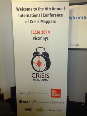
Crisismappers are converging in New York City this week for the 6th Annual International Conference of CrisisMapping. The term “crisismapping” is fairly loose as the global community includes diversity in maps, data informatics, humanitarian technology and research. We are a collective of people who use maps, data and technology for humanitarian aid and international development. This year’s theme is: Affected Communities in the Spotlight.

More about ICCM

ICCM continues throughout the weekend. The main event is Friday, November 7, 2014 with keynotes and ignite talks. This will be livestreamed so that you can watch along from home or offices. Join the Crisismappers community to learn and build with us.

#iccmnyc

Follow us on the live stream: bit.ly/iccmnyclive

The ICCM 2014 Agenda

ICCM 2014

As the ICCM pre-conference training and field trips organizer is it my goal to unite the different disciplines in unique zones to build, learn and share. Our training offering is a community driven effort with 3 tracks: Maps, Knowledge and Mobile/Hardware. Sessions are ongoing all day today.

About Crisismappers:

The International Network of Crisis Mappers (Crisis Mappers Net) is the largest and most active international community of experts, practitioners, policymakers, technologists, researchers, journalists, scholars, hackers and skilled volunteers engaged at the intersection of humanitarian crises, new technology, crowd-sourcing, and crisis mapping. The Crisis Mappers Network was launched at the first International Conference on Crisis Mapping (ICCM) in 2009. As the world’s premier humanitarian technology forum, we engage 7,000+ members in over 160 countries, who are affiliated with over 3,000 different institutions, including more than 400 universities, 50 United Nations agencies & projects, first responders operating in both the civilian and military space, dozens of leading technology companies, several volunteer & technical community networks and global, national, and local humanitarian and disaster response and recovery organizations.

Pre-conference Training

The Maps track including many diverse map software organizations and communities. Sessions include Google (Christiaan Adams), CartoDB (Andy Eschbacher), Mapbox (Matthew Irwin, Aaron Lidman), Ushahidi (Sara-Jayne Terp), HOT/OSM/American Red Cross (Chris Daley, Dale Kunce) and ProPublica (Brian Jacobs sharinig about remote sensing verification).

Research/Knowledge: What is the impact of Crisismapping? What are some ways to monitor and evaluate projects? Which ethical scenarios do we encounter? How can design of a map or data collection tool change the data? Can we use human centered design? What is the current state of research in crisismapping?

There are two sessions in this ½ day Research/Knowlegde track:

1. Open Data for Resilience Initiative (OpenDRI) (John Crowley)
Natural hazards with low frequency can lurk in history’s invisible depths. How do we use open data to help affected communities to map and see these risks? How can open data help governments and donors invest in building resilience in the areas which have the highest impact for affected communities? Learn the tools that the World Bank’s Global Facility for Disaster Reduction and Recovery has built to use Open Data to drive Resilience.

2. Education project in Guatemala tracking mapping needs. (Colette Mazzucelli, NYU) introduces the Pre-Training Session. Kyle Matthews, Senior Deputy Director, Will to Intervene Project, Montreal Institute for Genocide and Human Rights Studies (MIGS), Concordia
University will begin the conversation. Kyle will introduce the Digital Mass Atrocity Prevention (DMAP) Lab at Concordia University as well as the ways in which MIGS Professional Training Programmes on the Prevention of Mass Atrocities have integrated analyses of mapping
technology projects. Cristian Silva, Director, IFIFT, will highlight our experiences in Guatemala participating in the Multidisciplinary Field School: Forensic Investigations. We will then respond to questions from those in attendance. This will be followed by a brainstorming session with NYU GIS Librarian Andrew Battista and NYU Senior Technology Specialist Him Mistry coordinated by Colette Mazzucelli and the ICCM 2014 Team.


Mobile and Hardware

Mobile and Hardware (eg. mobile apps, Google Glass, imagery, satellites, drones etc) are incorporated into many crisismapping projects. Crisismappers are exploring new technologies to collect data and map in the field. This session will highlight tools and techniques.

The following workshops will be provided:

Integrating inclusive technology (Valerie Oliphant, Social Impact Lab)
This workshop will explore the idea of inclusive technologies. What makes a particular technology accessible in a certain place and time? How can implementers assess their operating environment to choose technologies, channels and tools that best fit their needs?

We’ll be looking at how to determine the accessibility and usability of different initiatives for different projects and contexts. Do people own or have access to mobile phones? Do they use SMS? Which mobile networks have coverage? How can SMS empower community workers? We’ll also cover how to map out your project in a simple way that exposes risks and incentives.

PUNYA (Lalana Kagal, Fu-ming Shih, Andrew McKinney and Evan Patton MIT))
We have been working for the last two years in a system that allows anyone to quickly prototype and build mobile applications for crisis mapping and other humanitarian ends. The project name is PUNYA (http://air.csail.mit.edu/punya/), and it is completely free and open source.

Geothings
(Kuo-Yu (Slayer) Chuang)
This session will be discussing and testing disaster responding scenarios with ICT tools (SMS).

http://geothings.tw/


Reality Check on Mobile Health
(Michelle Hamilton-Page (Ushahidi))
In this workshop we will look at some examples of how health promotion is leveraging mobile – including near field communication, SMS and smartphone apps – to work with communities to build relevant, iterative tools for health. Let’s crowd-source some successes and failures in health and mobile tech and check in with where things are going from the local to the global context.

http://www.ushahidi.com/

ICCM Field Trips

From Balloon Mapping to oil testing kits, Public Lab is leading the way with environmental data collection. How can we have the earth talk to us and how can we collect environmental information around the world? We can build our own sensors and stitch our own maps. This workshop will teach you the skills in an urban setting.


Neighbourhood Resilience Field trip with Green Map: Hurricane Sandy Zone
(Wendy Brawer)
Occupy Sandy and local communities built placemaking and infrastructure to communicate and support a community in need. Emergency managers are building programmes to make the region more resilient. How can crisismappers learn from this field experience?

http://www.greenmap.org/greenhouse/en/home


Office of Emergency Management - City of New York
(Jim McConnell)New York City has one of the largest urban emergency ops centers. In this field trip, you will learn about their work and how they use crisismapping techniques.

Thank you to all the organizers, sponsors, participants and especially the Black Box Communications team for making this a success.
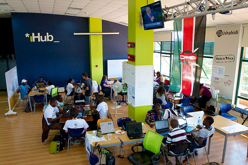
7Nov

Putting on our Training Hats!

You’re invited to a skillshare pre-conference day with fellow Crisismappers. The International Conference of CrisisMappers (ICCM) will be held November 18 – 22, 2013 in Nairobi, Kenya. (About the full ICCM Conference.)

If you just want to attend the pre-conference training, you are very welcome! It is open to EVERYONE for a small fee ($50.00) paid to the ICCM conference. The trainers and speakers are local and national leaders. We hope you will join us at the ihub on Tuesday, November 19, 2013.

See more ihub and Ushahidi pics

About the Training

ICCM Training Day will have 4 tracks: Mobile/Security, Maps, Data and Knowledge. Each track will have sub-sessions and directed training. Participants can elect to join in one whole track or pick the individual sessions within the tracks. The purpose of this to give more hands-on training and allow folks to learn/share in smaller groups.

This is our ICCM Pre-conference day Draft Schedule. (Note it will be updated in the coming days)
We will add more details about the sessions and the bios of the speakers/trainers here.

How can I join?

To Join you can sign up for the Crisismappers Network, then click “ICCM 2013″. There you will find details about the registration login.

If you have any outstanding questions, send a note to Heatherleson @ gmail DOT com with the subject line – ICCM Pre-Conference Help wanted. Then, complete the registration. If you have questions about the full conference – please contact melissa at crisismappers dot net.

Outreach help wanted

We have more space open for the pre-conference training, Can you reblog my post or tweet this to your local communities? The sessions will offer a breadth of knowledge and expertise from security to research to map and data. We know folks will want to dig in and learn.


TWEET ME:

Join @crisismappers Pre-conference training- Nairobi – Nov. 19th. All welcome. Please register. Details: http://bit.ly/17fSDeE

********

Thanks a million to my fellow trainers, to ihub/ ihub research for hosting us and for Ushahidi (love you guys) for keeping us in food and drink!

22Oct

Global Community: the road to learning

For the past 3 years, I have focused on building global community via maps, hacks and data. The journey has introduced me to a number of communities plus I’ve been fortunate to lead efforts in a few great spaces.

For the past month, I’ve been head down at Open Knowledge Foundation working on the Open Data Partnership for Development project as well as learning all about Open Knowledge Foundations’ communities and networks. We have the amazing opportunity to activate everything from open data to open government to open science to open glam (galleries, libraries, archives and museums.) Having library training background, I’ve always thought that the Internet opens up large borderless communities, much like the old Mechanics Institutes*. It gives us a chance to connect with fellow leaders and support the unusual suspects who want to use new technologies to disrupt and activate change.

stools aiweiwei
(Stools by Ai WeiWei)

Some might consider it a tall order to involve citizens and technology to activate change. I see it as an art. What if we looked at it differently? Many of us are focusing on building stuff and showing the potential of opening data, creating apps and convening at hackathons/sprints. Others are focused on analyzing our methods. Great! We need to have real-time analysis/research in all our projects. Giving evidence and showing impact is mandatory as we move forward. ABC: Always be communicating/changing. Some folks make a career out of highlighting the faults in the old systems and faults in attempts to use new technology to see the world and the information overload in a new way. Also, great. The truth is: None of us are getting it right, yet. But, we are trying.

Meeting, Making and Showing

In the next month, I am going on a whirlwind of meeting, making and showing. Each of these spaces involve communities of folks trying to use policy, information, maps, hacks, data and more to open up our world. It is a huge privilege to participate and learn. I’ll try to post some ‘Dispatches’ as I have done at previous events:

1. Mozilla Festival – London, UK October 25-27, 2013.
MozFest is a home for me. I’ve attended each of the fests including its predecessor (Drumbeat). Imagine rooms full of brilliance in everything from Open Hardware to Open News to Open Internet. My brain and heart will burst with happiness in seeing old friends and digging into learning while making stuff. There are few events that are this interactive. The Open Knowledge Team will be hosting a few sessions (Building collaboration across the open space and a Data Expedition)

2. Open Government Partnership Summit – London, UK October 29 – November 1, 2013
The OGP summit connects governments and civil society communities to discuss policy and demonstrate the latest actions by country, topic and movement. The Open Data Partnership for Development is focused on helping connect governments and civil society folks. My goal will be to meet others on this journey and see how I can help support their efforts. As well, the Open Knowledge Foundation team will be supporting the Civil Society Day.

3. International Conference of Crisis Mappers – Nairobi, Kenya November 18 – 22, 2013
The Crisis Mappers community is one of the most amazing ones that I’ve encountered. Each of us from business to open source to government and academic want to learn the best ways to use data, mobiles, informatics and maps to aid crisis response. We will meet for a week of training, ignite talks and collaboration/simulation. The opportunity to do this in Kenya is amazing. My heart remains in East Africa. Ushahidi was born there and has inspired so many of us to consider how citizens can and should be involved in the conversation. I’ll be running a full day training session with 4 tracks: Maps, data, mobile and knowledge. There are many community leaders helping out, including my colleague Michael Bauer of the School of Data.

I am really look forward to involving more people in each of these communities.

Here’s to amazing building and making. I am more than certain that the next weeks will shape the coming year and far beyond!

*On Mechanic’s Institutes: I had a membership at the Atwater Mechanic’s Institute in Montreal, Canada. I loved that I could use a library and get training. It is the way forward: we need to train a digital network of new leaders to use the power of technical skills to tell stories and use data/software to activate new ideas/change in their communities.

4Jan

Coining Global and Hurricane Sandy

In December, I had the honour to present at the United Nations Spider meetings in Vienna. Here are those presentations with details notes:

Coining Global is a state of community for where Crisismapping and Digital Humanitarianism should grow:

Hurricane Sandy saw the rise of many Crisismapping projects, including the great Hot or Not test of satellite imagery. There was also a large number of Crowdmaps launched:

4Apr

Changes: Volunteering Globally, Nationally and Locally

Volunteering is a gift. For the past year, I have been part of the CrisisCommons – Global Core Team as the co-lead of the Community Working Group. We grew the community from US, Canada, UK and New Zealand to other events and volunteers in Australia, France, Thailand, Belgium and others. I volunteered on efforts for Haiti, Chile, Pakistan, New Zealand and Japan. I contributed to the writing of the content for the CrisisCommons Sloan Foundation Grant, especially the city and project profiles.

A number of reports about Volunteer Technical Communities have been released in the past weeks. They really speak volumes about how each individual volunteer and group changed the world. I am proud to be part of all these movements. We are friends and partners in leadership and volunteerism.

Reports:

  • UN Foundation – Disaster Relief 2.0: The Future of Information Sharing in Humanitarian Emergencies
  • Global Facility for Disaster Reduction and Recovery – Volunteer Technology Communities: Open Development

  • (picture by Tolmie Macrae).

    Today, I made the following announcement on the CrisisCommons global and CrisisCamp Toronto mailing lists:

    Morning everyone, Hope your weekend was grand.

    For the past year, I’ve been your CrisisCommons Global – Community Working Group co-lead. And, what an adventure it has been. I will be stepping down from this volunteer role effective April 4, 2011. With this change, I will transition my responsibilies to Chad Cataccchio, who is a co-lead of this group. He sent a call to action for the Community Working Group yesterday.

    One of the big lessons learned about CrisisCamps is preparedness. I believe in this community and will continue to volunteer as the CrisisCommons/CrisisCamp Canada lead and CrisisCamp Toronto lead.

    I am honoured and proud to have volunteered in this role. I will continue to play a part within the global community when and where I can.

    Thank you,

    Heather L.

    What’s next:

    I will continue to volunteer on a number of projects including:

  • Grow CrisisCamp Toronto and in Canada as well as support CrisisCommons global when I can.
  • Continued involvement in the Missing Persons Community of Interest Working Group, CrisisCommons.
  • Collaborating withUshahidi friends on the on mbfloods.ca and skfloods.ca initiatives
  • Organize and support Random Hacks of Kindness 3.0 for June 4/5, 2011.
  • Mapping the world with Stand By Task Force and CrisisMappers communities.
  • Fostering Mozilla Drumbeat projects. There is a real opportunity to connect Volunteer Technical Communities to projects within Drumbeat. For example, P2PU.org, Webmademovies and Universalsubtitles.com offer resources which could assist these global communities. But, mainly I am fan focused on the existing projects supporting an Open Web.
  • 5Mar

    Maps and Mappers

    Do something. During the CrisisCommons response to Haiti, I learned about the Crisismappers network. When the Chilean earthquake occurred, our CrisisCamp Toronto team got a crash course in Ushahidi and crisismapping by creating training materials while we learned how to map. We also volunteered for the Pakistan floods using the same tools and community networks. I became hooked. Geo-locating situational awareness and potential needs to provide context to humanitarian response continues to evolve. I am a mapper-in-training (MIT) and a serial volunteer.

    In October 2010, I attended the International Conference of CrisisMappers. The calibre of organizations, academics and volunteers inspired me to join the newly formed Stand-by Task Force (SBTF). The SBTF is a collective of highly skilled, diverse people from around the world who can be activated to respond. As George Chamales of Konpa Group likes to say: a map is only as useful as the process and people to make it happen. It is hard, iterative work to map. But, the rewards mean contributing to a new, visual response. In January, I volunteered with the SBTF monitoring the Sudan elections with sudanvotemonitor.com. I spent time working with the geo-locating team.

    I could spend a few years learning and still not be an expert. Everyone starts somewhere. While I have volunteered with Ushahidi and maps for a year, there are many layers. The CrisisCamp Toronto team is modeling and testing maps as a volunteer offering. We created Snow in Toronto. I applied the SBTF methods and cross-trained my local peers on how and what to map using the best practice templates and processes.

    Maps

    Mapful. The last weeks included large scale responses for the Standby Task Force and CrisisCamp. Digital volunteers from many groups have answered the call to action.

    New Zealand – eq.org.nz

    Monday, February 21st was the end of a long weekend. Upon checking my twitter stream around 20:30, I learned about the earthquake in New Zealand. I logged on to skype and began collaborating with people from around the world for 8 hours straight. We activated the Stand-by Task Force to assist with the initial response and training. I was given the honour to chronicle the experience on the Ushahidi and CrisisCommons blogs: Launching eq.nz.org for the New Zealand Earthquake.

    In 12 days, the CrisisCamp New Team and friends have filed 1,355 reports and 10 layers of information. Their work has been chronicled on the CrisisCommons wiki and blog.
    All the NZ folks like Tim McNamara, Robert Coup, Nat Torkington, Gavin Treadgold and hundreds of volunteers are changing the face of emergency response in NZ and inspiring people around the world.

    Libya
    The Stand-by Task Force was activated this week for a special project for the United Nations – Office for the Coordination of Humanitarian Affairs (UN-OCHA). This historical action involved crisismappers in the humanitarian response. I joined the SBTF deployment team and began research social media resources and mapping. Four days later we have hundreds of reports verified and continue to volunteer. This effort included many diverse groups – CrisisCommons, Humanity Road, CrisisMappers, Google Crisis Response Team, NetHope and OpenStreetMap. Patrick Meier, Director of Crisismapping at Ushahidi, and Sara Farmer, Chief Platform Architect at UN Global Pulse blogged about the the Libya response. The map is not publicly available at this time due to the sensitive nature. Mappers do no harm, we just want to help. In time, it will be available. Volunteers are most welcome. You can contact the Standby Task Force.

    Digital Mappers

    Digital volunteers from the various Volunteer Technical Communities (VTCs) are involved in crisismapping. There are hard-core geo mappers like the OpenStreetMap and the Google Earth folks. And, there are groups like CrisisCommons, Crisismappers, and Humanity Road who provide surge capacity and often focus on situational awareness and research from social media, media and official sources. Add to this, the Ushahidi development team and other technical volunteers.

    Who are these digital mappers? Well, they are doers. A mapper doesn’t want to talk for hours about doing, they just do. It takes a new volunteer about 4 hours to wrap your head around the process and begin to really dig in. The SBTF have worked on a number of deployments and are very open to new members. We are the people who map for 3 hours at night instead of watching tv. We are the people who wake up early before work, log into skype and add a few reports to the map. We map at lunch. We are the people who may drop everything to map for 4 days. We are communicators and friends. And, we believe that a map can and does change the world. Every day I am more and more honoured to call myself a mapper. While it might not show immediately that we are making a difference, it will in time. Iterative change starts with a few hours and a few dedicated people who want to make a difference.

    Heather

    18Feb

    Social Media in Canadian Emergencies – CrisisCamp Toronto

    The CrisisCamp Toronto team has been working hard to prepare for CrisisCamp Social Media in Canadian Emergencies. This morning I was delighted to receive some great response from the IAEM – Canada mailing list. Our goal is to connect the spirit of Canadian startup innovation, internet savvy and emergency managers.

    When: Saturday, February 19, 2011 10am – 5pm Where: University of Toronto, OISE 4th fl

    Here is a list of Communication channels to participate during CrisisCamp Toronto.

    LiveChat- Social Media in Canadian Emergencies on Saturday, February 19, 2010,
    14:00ET, 11:00PT for one hour

    We’re hosting a tweetchat (live chat on twitter.com). If you search twitter.com for #CSMEM you can follow all the comments. If you have a twitter account, please use the hashtag #CSMEM and add your province code. (Eg. SK, NFLD). This session will be held in both English and French. We will have translators to help. It is our hope to host these regularly. Our American friends use the #SMEM hashtag.

    Twitter hashtags

    Follow us on Twitter : @crisiscampTO
    #CSMEM
    #CSMEMchat

    Also see: @crisiscamp, @crisiscommons and #SMEM

    Liveblog

    I saw a demo of Scribblelive at Hacks/Hackers this week. I think it is a great fit for CrisisCamp Toronto’s event. It is all set up and ready to start posting content tomorrow morning. I also downloaded the free Iphone app. If it works for this event, I’ll be recommending it for more events in the future both in Canada and globally.

    Ustream

    We will try to stream and record the morning sessions. This will help other folks learn. Again, it will be active around 10:00 ET on Saturday.


    Live Videos by Ustream

    Schedule for the day

    10 – 10:30ET – Introduction
    10:30 – 1:00ET Morning session

    Education Stream
    We will run these three sessions, three times. You can pick which one you want to attend.
    1. Emergency Management 101/Emergency Management in Canada
    2. GIS/Mapping 101
    3. Social Media 101/CrisisMapping 101

    Dev and Tool Testing Stream
    *Crowdmap/Ushahidi 101- test case and cross-training
    *Ushahidi small code features – TBD

    Other activities:
    *Prep for #CSMEM Twitchat
    *Canadian Virtual Volunteer Team planning: help us brainstorm credentials and organization for this idea.

    1:00ET Lunch

    Afternoon: 1:30 – 4:30pm
    2:00-3:00ET – Live chat on Crisis Commons and Social Media in Emergency Management (skype – Heather Leson – Twitter #csmem)

    1:30 – 2:00 Brainstorming ideas with Melanie on CrisisCommons Canada activities
    3:00 – 5:00 ET

    1. Project Demos
    CrisisCamp Toronto wants to pick a project to work on. Demo your project idea in 5 minutes, then we will vote
    2. Project Planning
    We will build out the project requirements and next steps
    3.Ongoing work playing with tools will continue in the other rooms.

    5pm Event complete.

    Join our CrisisCamp TO Mailing list

    © Copyright 2016, All Rights Reserved