Tag: openstreetmap

18Aug

Co-creating and Celebrating Humanitarian OpenStreetMap Team

Maps connect us and tell stories. On Thursday, September 22, 2016, the Humanitarian OpenStreetMap Team will convene for our 2nd annual HOT Summit in Brussels on the eve of the State of the Map conference. Both events celebrate OpenStreetMap and the community.

HOT Summit Logo

Top 5 Reasons to be at the HOT Summit

1. Leaders will share their map stories from around the globe

Check out the amazing programme of speakers from Indonesia, Canada, US, Tanzania and more.
HOT activation traininng in Jakarta

(Photo by Mhairi O’hara at the HOT Activation Workshop, Jakarta 2015)

2. Meet and build HOT and OSM together

The map is bigger than one individual. It is a community, a network of networks.

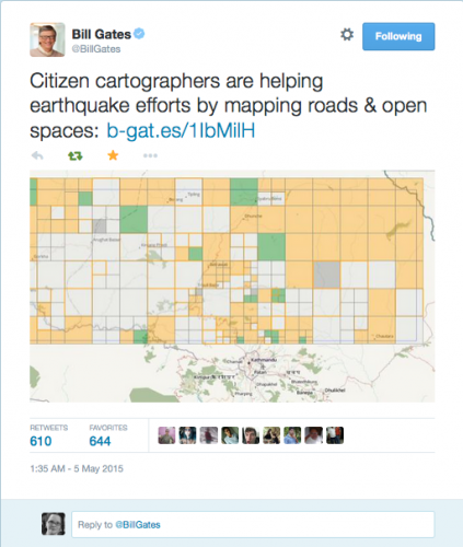
Bill Gates on OSM in Nepal Response May 5, 2015

3. Provide input into HOT’s future strategic planning

We are 6 year’s young and so much to do. Give us advice, take a task, share your experience, express your opinion. We will have many conversations and coffee conversations about the future of HOT. Help us co-create this strategy.

Road by BraveBros. from the Noun Project noun_106568_cc

(Image credit- Road by BraveBros. from the Noun Project)

4. Learn new skills from peers

The talent in this community to teach each other is amazing. Having an in person space to learn, ask questions, grab a side table to map makes the HOT Summit a space for everyone. Just ask. I am sure that we will find someone who can answer your questions or even learn a thing or two from you!

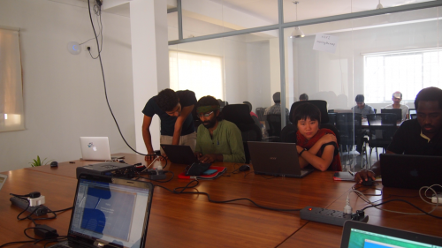
Mapping Nepal (photo by Gopinath Parayil))

(Photo for the Nepal Earthquake response by Gopinath Parayil)

5. Have fun mapping for change with your new friends

A few of the HOT community attended the World Humanitarian Summit. Many of us had not met before in person. Times of laughter and solidarity make all the difference.
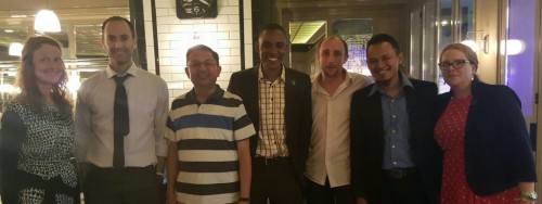
HOT at WHS 2016

(photo for WHS 2016 using Heather’s phone)

Why join us?

How can we get to the next million participants creating the largest open map? How can improve everyone’s experience from novice to advanced? What are some of the project highlights from around the world?

Achieving our mission to help humanitarians and economic development with OpenStreetMap means widening the circle. Sure, we will talk fine details about mapping, but there is space for everyone to explore and contribute. Even if you are not a ‘mapper’, but are curious about open source and open mapping, then join us. We aim to improve the map and grow the global community. Over the past months, our team has been demonstrating how HOT can help achieve the Sustainable Development Goals and help humanitarians with Missing Maps. This action packed day has tickets available for 66.24Euro. (Register today!)

15Jul

You can MapSwipe!

Every day we use our phones. We tap, we read, we photograph, we chat, we view, and we connect. But wait! What if your ‘tapping’ time could help a humanitarian? Queue MapSwipe.

mapswipe_lockup_whiteblue larger

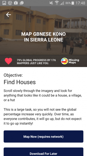
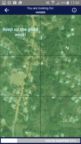
Your quick tapping decisions about images could save mappers time and help the most vulnerable. Satellite imagery for project regions are added to MapSwipe. Then, we give you project tasks focused on looking for key items. For example some projects will look for houses, if you see a house in a tile, you tap once for yes (tile turns green), if you are unsure you tap twice (tile turns yellow) or if the tile is flawed (blurry), then you tap three times (tile turns red). Multiple people look at the tiles so that we can crowdsource to higher accuracy. Once the project is completed, we share the curated data with mappers who will review and map the data on OpenStreetMap. All of this is to help humanitarians have the best map possible.

MapSwipe main project screen “In a humanitarian crisis, the location of the most vulnerable people is fundamental information for delivering food, shelter, medical care and other services where they are most needed. And, although it may be hard to believe, millions people around the world are not represented on any accessible map.” (Pete Masters, Missing Maps Coordinator, MSF, July 14, 2016)

MapSwipe is available today on the Google Play and Itunes stores. Download and MapSwipe Today!

MapSwipe is a Missing Maps project aimed to proactively map the places in the world where the most vulnerable people live before a crisis happens. Missing Maps is a partnership between Medecins sans Frontieres, American Red Cross, British Red Cross, Netherlands Red Cross, CartoONG, and Humanitarian OpenStreetMap Team.

Please share MapSwipe widely with your friends and family. And, do let us know how we can improve. Help bit counts!

About MapSwipe Team and Project

MapSwipe was funded by MSF UK for the Missing Maps Project. Currently, all projects are for Missing Maps partners, but this might change in time. The tool was developed by an amazing team. Congratulations Ivan, Pim, Sadok, Alison, Pete, Astrid and Bennie. You all inspire me. (Note: My contribution of advisor was on my personal time as a proud Humanitarian OpenStreetMap Team Board Member. )

Imagery is provided by Bing (Thanks Microsoft!).

Thanks for Mapswipebe a mobile volunteer with mapswipe

18Jul

Visualizing flux: Time travel, torque, and temporal maps

[Cross-posted from Opensource.com. The original article was published July 17, 2015 as part of the OSCON Interview Series.]

Mapping communities in the open source space are growing as more and more people use maps for business and social change. Leaders like Aure Moser are providing spaces for people to learn and be inspired. Prior to her OSCON session and in the middle of a busy travel schedule, she shared some insights into the communities and her experiences.Aure Moser

Aure is a developer and curious cartographer building communities around code at CartoDB. Her background blends science and scripting, and includes a cocktail of conservation chemistry, eco-enthusiasm, education, and egalitarian tech activism.

Previously of Ushahidi and Internews Kenya, she’s been working in the open tech and nonprofit journalism space for a few years, and recent projects have had her working with mapping sensor data to support agricultural security and sustainable apis ecosystems in the Global South.

Q & A


You’re an active member of the OpenStreetMap Community, most recently volunteering at the State of the Map US 2015. What inspires you about this project?

I love OpenStreetMap, and am a happy recipient of a scholarship to speak at State of the Map in Buenos Aires (2014). It is the democratization of information that the OSM community embodies, and as a former librarian I have always loved the idea of open source web architects as intellectual social workers. We have such a beautiful opportunity as software engineers to learn from the iterative requirements and pace of open source and open data initiatives, and crowdsourced efforts to break from the exclusivity of proprietary platforms have a special place in my heart.

CartoDB has been a great support of open source, open data and open mapping. Can you share some examples about how you and your team incorporate this into your work?

Open source is so important to our mission to make maps more accessible, and it’s been essential for our stack development as we progressively learn from community requests and contributions. Our software is engineered for ease-of-use, and our GUI Editor interface is an effort to make mapping projects more accessible to non-GIS experts. Everyone should be able to map found, open, and personal data, easily. At the same time, we have almost all of the functionality accessibility in our editor, available via our open source libraries and APIs. We have Carto.js for making maps, Torque.js for time-series data mapping, Odyssey.js for building chapterized narratives on maps, Vecnik.js for vector rendering, as well as our Import, Map, and SQL APIs to facilitate easy and open map-building in code.

As part of the Community Team at CartoDB, I’m also pretty passionate about our education and outreach initiatives beyond just the open libraries and APIs. Giving talks and workshops on our software has encouraged us to build remote learning opportunities for our users, so we host webinars and themed workshops to support our community. The Map Academy is a series of online lessons in all aspects of mapping (not restricted solely to the use of our software) that we maintain to help mapmakers learn about Javascript, PostgreSQL, PostGIS functions, and the mechanics of map design. Likewise, we document and publish our workshops and talks on a public mini-site that we invite our community of educators and active users to contribute to in the course of their curriculum development.

When you were with Ushahidi, you spent time in Kenya. Building map projects and training in the Global South has some incredible stories and insights. It would be great to hear what you learned about the open source communities working there. And if you can, provide some examples of mapping projects in the Global South.

The level of creativity and resourcefulness in developing technology with profound infrastructural challenges was incredibly impressive and inspiring throughout iHub (Kenya) and in other locations. There can be a general insensitivity to the persistent challenges that people face when technologists provide open source products that only operate under optimal conditions and high-bandwidth communities. Working within other cultures and under the creative constraints of poor connectivity or strained infrastructure makes you think about how limited the value of your product is when it fails in the face of easy deployment and reuse globally. Those experiences were valuable to challenging my assumptions of digital literacy, and my flexibility in designing products of greater utility. I really benefited from exposure to Ushahidi’s team, and the network of subcommunities that their products have engendered. I’ve always been impressed by what Humanitarian OpenStreetMap Team and humanitarian teams globally were able to accomplish via crowdsourced efforts.

Having left Ushahidi, I’m still pretty involved with similar groups and had the opportunity to work with many journalists, especially at Internews-Kenya, on developing independent mapping projects. At Internews, I had the chance to collaborate on a map-interactive piece with Eva Constantaras and InfoAmazonia to explore narratives around mapping extractive industry in Kenya, called LandQuest. The project uses Jeo, a WordPress theme developed by InfoAmazonia out of Brazil, to make map mashups with blog-style publishing platforms, and the theming flexibility is pretty sweet. I’m also on the advisory board for an amazing group of technologists building toolkits for activists in the Global South called Beautiful Rising; among other resources, we support civic hacking and mapping projects to empower community builders and journalists.


How do you see the industry evolving over the next few years?

I think it’s safe to say that we will progressively collapse the distance between ourselves and our devices so “wearable” and “Internet of Things” futures are possible. I would say that we’re in a strange intermediary technology period now, where we’re pretty persistently developing products as an industry that provide a liaison to the future with a foothold in the past. In the same way that DVD/VCR combos were a short-lived intermediary before the obsolescence of the VHS player, we’re prototyping a lot of digital prosthetics that do things like put glasses on people who don’t need them or provide technical crutches to people otherwise unimpaired. I think there’s a great future in wearables and more fusion of physical technologies with software projects and dynamic mapping, and I’m pretty excited about it.

Since your talk is about time travel, where and when in time would you travel if you could?

Oh wow, such a great yet impossible question. There are a lot of historical events that I would naturally love to have witnessed if only for the Doctor Who/Quantum Leap opportunity to define what actually happened. I guess the less inventive and more egoistic part of me would love to have a Christmas Carol experience where I revisit or project potential outcomes in the Many Worlds possibilities of my future. So I’m pretty happy where I am, way beyond where I could be.

24Feb

OSM needs you: join the OSM Hack Weekend

At Toronto’s International Open Data Hackathon event this past weekend, it struck me how many folks would love to know how to use and how to build tools to support the OpenStreetMap community. Conversation after conversation folks mentioned that they wanted to learn more, do more.

Well, this is your chance Toronto.

The Toronto OSM community is a dedicated group hosting their second Developer Hack Weekend from March 8 – 10, 2013. An OpenStreetMap “Hack Weekend” is a local event for technical work to improve OpenStreetMap. They are holding intro sessions, socials and a developer focused hackathon.


Full details about OSM and this event can be found on the OSM wiki.
If you haven’t created an account yet, anyone can join OSM. There are many ways to start contributing. Just join and start connecting.

OSM
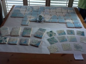
(Photo from Toronto’s OSM 8th Birthday party. Cookies courtesy of Meg the awesome.)

Three ways you can get involved:

1. Join one or all of the events.
There is a great mix of learning, social and developer action events. OSM is supported by developer projects that make the mapping possible. I’ve added the links and some details below.

2. Help spread the word
“Support OSM globally and in Toronto. Join the OSM Hacker Weekend: March 9 – 10, 2013: http://wiki.openstreetmap.org/wiki/Toronto_Hack_Weekend_March_2013#Who.27s_coming.3F”

3. Help Sponsor
Like every hackathon, OSM could use a hand with food and drink. If you or your organization can lend a hand. The contact and event organizer is Richard Weait. Ping him:RWeait at Gmail dot com.

OSM Intro Session and OSM Social

There are monthly Toronto OSM casual mappy hours to meet and connect with other OSM users and fans. I’ve been attending for awhile and always learn something new. Getting an introduction to OSM is really the best place to start, so take a break on Friday afternoon and check out the session. If you can’t miss work for the sake of mapping, you can catch the Friday night Mappy Hour. It is my understanding that guest mappers and hackers are coming into town. This is a chance to learn about OSM plus get a deeper understanding of the Hack weekend opportunities.


Register for OSM Intro Session (Friday, March 8, 2013 14:00 pm EDT)

Register the OSM Evening Meet and Greet Mappy Hour (Friday, March 8, 2013 18:30pm EDT)

Your Weekend is better if you Hack for OSM

These are the core of the event and are cast from the same OSM Hack Weekend alloy that has lead to important advances in the OpenStreetMap infrastructure and tools. If you have wanted to know how to become a developer – contributor to OpenStreetMap, this is your best opportunity to learn from and share with the experts.

OSM Saturday and Sunday Code Sprints:

Join Saturday’s code sprint
Join Sunday’s code spring

There are many mapping projects that you can get involved in within the greater OSM community. It has been such a pleasure to get to know them via the Humanitarian OSM community. I’d encourage you to find your special niche and map away!

18Feb

Social Media in Canadian Emergencies – CrisisCamp Toronto

The CrisisCamp Toronto team has been working hard to prepare for CrisisCamp Social Media in Canadian Emergencies. This morning I was delighted to receive some great response from the IAEM – Canada mailing list. Our goal is to connect the spirit of Canadian startup innovation, internet savvy and emergency managers.

When: Saturday, February 19, 2011 10am – 5pm Where: University of Toronto, OISE 4th fl

Here is a list of Communication channels to participate during CrisisCamp Toronto.

LiveChat- Social Media in Canadian Emergencies on Saturday, February 19, 2010,
14:00ET, 11:00PT for one hour

We’re hosting a tweetchat (live chat on twitter.com). If you search twitter.com for #CSMEM you can follow all the comments. If you have a twitter account, please use the hashtag #CSMEM and add your province code. (Eg. SK, NFLD). This session will be held in both English and French. We will have translators to help. It is our hope to host these regularly. Our American friends use the #SMEM hashtag.

Twitter hashtags

Follow us on Twitter : @crisiscampTO
#CSMEM
#CSMEMchat

Also see: @crisiscamp, @crisiscommons and #SMEM

Liveblog

I saw a demo of Scribblelive at Hacks/Hackers this week. I think it is a great fit for CrisisCamp Toronto’s event. It is all set up and ready to start posting content tomorrow morning. I also downloaded the free Iphone app. If it works for this event, I’ll be recommending it for more events in the future both in Canada and globally.

Ustream

We will try to stream and record the morning sessions. This will help other folks learn. Again, it will be active around 10:00 ET on Saturday.


Live Videos by Ustream

Schedule for the day

10 – 10:30ET – Introduction
10:30 – 1:00ET Morning session

Education Stream
We will run these three sessions, three times. You can pick which one you want to attend.
1. Emergency Management 101/Emergency Management in Canada
2. GIS/Mapping 101
3. Social Media 101/CrisisMapping 101

Dev and Tool Testing Stream
*Crowdmap/Ushahidi 101- test case and cross-training
*Ushahidi small code features – TBD

Other activities:
*Prep for #CSMEM Twitchat
*Canadian Virtual Volunteer Team planning: help us brainstorm credentials and organization for this idea.

1:00ET Lunch

Afternoon: 1:30 – 4:30pm
2:00-3:00ET – Live chat on Crisis Commons and Social Media in Emergency Management (skype – Heather Leson – Twitter #csmem)

1:30 – 2:00 Brainstorming ideas with Melanie on CrisisCommons Canada activities
3:00 – 5:00 ET

1. Project Demos
CrisisCamp Toronto wants to pick a project to work on. Demo your project idea in 5 minutes, then we will vote
2. Project Planning
We will build out the project requirements and next steps
3.Ongoing work playing with tools will continue in the other rooms.

5pm Event complete.

Join our CrisisCamp TO Mailing list

15Jan

RHoK follow-up: Population Centers in Disaster

At Random Hacks of Kindness 2.0 (December 2010), volunteers from CrisisCamp TO, RHoK Seattle, Humanity Road, Sahana and OpenStreetMap joined to work on a project called: Populations Centers in Disaster. Each of our groups continue to commit time and knowledge to complete this project.

Three days after the devastating quake struck Haiti, the towns of Jacmel and Leogane were still isolated — no communication or transportation — though we knew people were there: 128,000 in Leogane and 40,000 in Jacmel. A data query tool that identifies high concentrations of population may help volunteer technology communities with their communication efforts. A lack of communication inside a population zone points to a problem and the query tools being developed may help speed up and improve volunteer contributions to situational awareness.

@Redcrossmom @CNN I know you have lots of crew on the ground in PAP but very little news is coming from outside of PAP – Jacmel & Leogane need help. (Twitter, January 15, 2010).

Situational Awareness

At the onset of a disaster, time lost means lives lost. As virtual volunteers, Humanity Road’s first response step is to identify affected hospitals. In an event that impacts a large geographic area, we need to quickly triage the situation and determine which population centers are affected. Part of this decision process involves identifying areas of population concentrations. For this, we have been turning first to Wikipedia to identify and understand the local area. Using this approach to search for information is manual, time intensive and requires multiple keystrokes of the same type of information. Manual research of standard information means time lost and that equates to lives lost. We look for cities within range of the epicenter of the earthquake or event, populations of those cities, hospitals within the impacted area, GPS coordinates, and local government structures for towns, counties and districts. Sometimes the absence of news does not indicate the absence of need.

RHoK

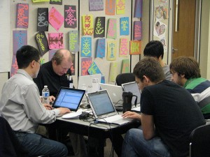
(RHoK Toronto, December 4, 2010. Photo by Cynthiagould.com)

The Project

We need a tool that would allow us to extract from Wikipedia into a Google Doc – the population centers for a defined area – such as City, District, Country. This would improve our volunteer response time. Humanity Road has previously worked with Sahana, Google, Gisli Olafsson and others to determine project needs.

The RHoK problem descriptions submitted included an outline for a query tool that would return the population centers within a boundary. The bonus tool would return results of hospitals in an impacted area, including contact information and GPS.

The RhoK Toronto team focused on the Hospital solution, while the Seattle team focused on the Population centers solution. The teams collected the data into Google fusion tables. By the end of the weekend, they had collected and stored a significant amount data that will help in future events.

The Next Steps

Data will reside within Sahana Eden, and be exported (Google Fusion Doc) for directed use by Humanity Road. Google Fusion Doc may have data limit parameters. The tool will help non-super users volunteering for Resource Management. Final product will reside on the Sahana database accompanied by the capability to extract specific hospital datasets.

The project needs presentation tools to help spontaneous volunteers work with the data. This includes criteria for data updates, to include the notes on impacts of infrastructure, operational impacts (damage, flood etc) of the hospitals query, developing the functional query for the populations center, and determining server space, and file formats for storing the data in open source format for all to access and use.

How you can Help:

1. Server space
2. DB specialist/developer to create query:finds objects (populations, host) within latitude and longitude radius. A query that finds “x” within radius of lat and long within the database
3. Support for a radius query to Sahana Eden

Our current project status:

1. Colin: talked with his Toronto – OSM folks about doing a OSM location hospital query
2. Heather/Cat/Pat: write a blog post and being outreach program
3. Terrance/Pat: will work on Sahana Eden component
4. Cat: will identify primary data fields
5. Colin/Pat/Terrance: share script
6. Pat: will start investigating the Final product- Sahana db, but with capability to have a hospital db can be pulled for a specifics.
7. Willow: Seattle team is on stand-by for the next steps.

We welcome any help you can provide. Contact: Heather (heather at textontechs dot com) or Cat (PeacefulIntent at humanityroad dot org)

Post by Cat Graham (Humanity Road) and Heather Leson (CrisisCampTO/RHoK TO)

© Copyright 2016, All Rights Reserved