Tag: Ushahidi

18Jul

Visualizing flux: Time travel, torque, and temporal maps

[Cross-posted from Opensource.com. The original article was published July 17, 2015 as part of the OSCON Interview Series.]

Mapping communities in the open source space are growing as more and more people use maps for business and social change. Leaders like Aure Moser are providing spaces for people to learn and be inspired. Prior to her OSCON session and in the middle of a busy travel schedule, she shared some insights into the communities and her experiences.Aure Moser

Aure is a developer and curious cartographer building communities around code at CartoDB. Her background blends science and scripting, and includes a cocktail of conservation chemistry, eco-enthusiasm, education, and egalitarian tech activism.

Previously of Ushahidi and Internews Kenya, she’s been working in the open tech and nonprofit journalism space for a few years, and recent projects have had her working with mapping sensor data to support agricultural security and sustainable apis ecosystems in the Global South.

Q & A


You’re an active member of the OpenStreetMap Community, most recently volunteering at the State of the Map US 2015. What inspires you about this project?

I love OpenStreetMap, and am a happy recipient of a scholarship to speak at State of the Map in Buenos Aires (2014). It is the democratization of information that the OSM community embodies, and as a former librarian I have always loved the idea of open source web architects as intellectual social workers. We have such a beautiful opportunity as software engineers to learn from the iterative requirements and pace of open source and open data initiatives, and crowdsourced efforts to break from the exclusivity of proprietary platforms have a special place in my heart.

CartoDB has been a great support of open source, open data and open mapping. Can you share some examples about how you and your team incorporate this into your work?

Open source is so important to our mission to make maps more accessible, and it’s been essential for our stack development as we progressively learn from community requests and contributions. Our software is engineered for ease-of-use, and our GUI Editor interface is an effort to make mapping projects more accessible to non-GIS experts. Everyone should be able to map found, open, and personal data, easily. At the same time, we have almost all of the functionality accessibility in our editor, available via our open source libraries and APIs. We have Carto.js for making maps, Torque.js for time-series data mapping, Odyssey.js for building chapterized narratives on maps, Vecnik.js for vector rendering, as well as our Import, Map, and SQL APIs to facilitate easy and open map-building in code.

As part of the Community Team at CartoDB, I’m also pretty passionate about our education and outreach initiatives beyond just the open libraries and APIs. Giving talks and workshops on our software has encouraged us to build remote learning opportunities for our users, so we host webinars and themed workshops to support our community. The Map Academy is a series of online lessons in all aspects of mapping (not restricted solely to the use of our software) that we maintain to help mapmakers learn about Javascript, PostgreSQL, PostGIS functions, and the mechanics of map design. Likewise, we document and publish our workshops and talks on a public mini-site that we invite our community of educators and active users to contribute to in the course of their curriculum development.

When you were with Ushahidi, you spent time in Kenya. Building map projects and training in the Global South has some incredible stories and insights. It would be great to hear what you learned about the open source communities working there. And if you can, provide some examples of mapping projects in the Global South.

The level of creativity and resourcefulness in developing technology with profound infrastructural challenges was incredibly impressive and inspiring throughout iHub (Kenya) and in other locations. There can be a general insensitivity to the persistent challenges that people face when technologists provide open source products that only operate under optimal conditions and high-bandwidth communities. Working within other cultures and under the creative constraints of poor connectivity or strained infrastructure makes you think about how limited the value of your product is when it fails in the face of easy deployment and reuse globally. Those experiences were valuable to challenging my assumptions of digital literacy, and my flexibility in designing products of greater utility. I really benefited from exposure to Ushahidi’s team, and the network of subcommunities that their products have engendered. I’ve always been impressed by what Humanitarian OpenStreetMap Team and humanitarian teams globally were able to accomplish via crowdsourced efforts.

Having left Ushahidi, I’m still pretty involved with similar groups and had the opportunity to work with many journalists, especially at Internews-Kenya, on developing independent mapping projects. At Internews, I had the chance to collaborate on a map-interactive piece with Eva Constantaras and InfoAmazonia to explore narratives around mapping extractive industry in Kenya, called LandQuest. The project uses Jeo, a WordPress theme developed by InfoAmazonia out of Brazil, to make map mashups with blog-style publishing platforms, and the theming flexibility is pretty sweet. I’m also on the advisory board for an amazing group of technologists building toolkits for activists in the Global South called Beautiful Rising; among other resources, we support civic hacking and mapping projects to empower community builders and journalists.


How do you see the industry evolving over the next few years?

I think it’s safe to say that we will progressively collapse the distance between ourselves and our devices so “wearable” and “Internet of Things” futures are possible. I would say that we’re in a strange intermediary technology period now, where we’re pretty persistently developing products as an industry that provide a liaison to the future with a foothold in the past. In the same way that DVD/VCR combos were a short-lived intermediary before the obsolescence of the VHS player, we’re prototyping a lot of digital prosthetics that do things like put glasses on people who don’t need them or provide technical crutches to people otherwise unimpaired. I think there’s a great future in wearables and more fusion of physical technologies with software projects and dynamic mapping, and I’m pretty excited about it.

Since your talk is about time travel, where and when in time would you travel if you could?

Oh wow, such a great yet impossible question. There are a lot of historical events that I would naturally love to have witnessed if only for the Doctor Who/Quantum Leap opportunity to define what actually happened. I guess the less inventive and more egoistic part of me would love to have a Christmas Carol experience where I revisit or project potential outcomes in the Many Worlds possibilities of my future. So I’m pretty happy where I am, way beyond where I could be.
3Aug

Cameras as Evidence

(Cross-posted from the Ushahidi blog)

Deep in the mountains of Italy, Centro d’Ompio, we sat in a circle brainstorming Cameras as Evidence. What would it take to collect a good and actionable citizen report using photos or video? Lead by Chris Michael of Witness, we discussed and brainstormed. The Witness team and some of the participants have amazing experience in building human rights cases. Inspired by the beautiful setting for Info Activism Camp, we collectively pulled out all the stops to consider how we can help activists and citizen reporters create valuable and usable content for their mandates. While our session aim was not tool specific (e.g.Ushahidi), it remains very applicable for Ushahidians: our software, our community.

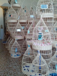
cameras in baskets

(Photo by Heather Leson, Venice Biennale. Art by Magdalena Campos-Pons)

3.0, Rich media content: Categories and custom forms

Some Ushahidi deployers use the power of rich media content, including video to give voice and document their projects. As we journey down the 3.0 road, we are thinking about how to improve.

The path to building 3.0 is very much considering how should categories be used and how can we make custom forms as flexible as possible. See our current discussion about the future of categories on the developers mailing list. This is a critical juncture, so you input will help us serve you better.

People are using both categories and custom forms to drive their data colletions missions. We’ve seen items that could be either a category or a custom form item. To be honest, I think that sometimes people use categories as work-around because custom forms have sometimes been buggy or are hard to use.

I will say that I am grappling with the different Ushahidi users – those who want to collect and analysis data and those who simply want to file a report. As you can imagine, this is a balance. Our community has discussed too many categories, very unclean/unclear data in the past.

If you are collecting videos and/or photos as part of an evidence-based project, here are some of the recommended data points to consider:

  • Title (useful)
  • Description
  • Location/GeoCode
  • Time and Date
  • Time point Highlights
  • Reference or corroborating information
  • License (use, consent, eg. creative commons)
  • Chain of Custody
  • visual geolocation (land marks)
  • clock, timeline, length
  • context – before and after
  • violations
  • weapons – materials
  • identification of people in footage, groups involved
  • other contextual videos
  • verbal information – context, language
  • security concerns
  • other filmakers
  • translator – references
  • timeline
  • details, serial #, clothes, id, tattoos, wounds
  • length of video
  • filmaker name and contact details
  • device details
  • surrounding scenes
  • locations of all involved
  • original video
  • bitrot – is it playable
  • posting information – all, originals, copies
  • missing clips, edited?
  • transcribed?
  • file format
  • resolution
  • frame rate
  • livestreaming?
  • who has it been sent to, who has the files, where to share and not to share
    purpose of video? – eg. change situation, document, share, influence, action
  • Unique id
  • categorization by file
  • sound quality, notes about sound (eg. guns, shouting, tone)

Alright, that list makes me contemplate: how are we going to incorporate this without scaring off reporters? How can we make video useful as part of the map mandate?

What do you think? What is missing? Do you think we should have a suggested custom form for video reports?

Some resources

Ushahidi Toolkits
Witness Toolkits

Thanks to Tactical Tech Collective for bringing us together to collaborate.

29Nov

What kind of Internet do you want?

The Internet is our community garden, our public space and our workshop. Every day I work with people around the world who create maps and technology for good. A free and open Internet invites this collaboration beyond borders, religion, politics and societal barriers.

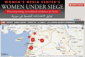
Crisismappers, particularly, conflict mappers do some of the bravest and scariest acts of Open Internet Activism. They take my breath away giving voice to the dispossessed, documenting atrocity and informing the world. Two such mapper groups are Syria Tracker and Women Under Siege Syria. Reports of a full communications shutdown in Syria takes away their voice. They should have the right to voice. We should protect their right to voice. What will the impact of this outage be on their important work?

Lauren Wolfe, Director of Women Under Siege, was interviewed a few months ago by the Canadian Broadcasting Corporation’s The Current (audio) about this project and their verification process.

Women Under Siege

****
The Syrian Internet shutdown was reported as I was writing this post about why the ITU and WCIT need to open their doors and not make decisions on behalf of the globe. More about this from the Mozilla andGoogle’s Take Action sites.

****

What kind of Internet do you want?

Webmakers

At Mozilla Festival, we remixed video with Mozilla Popcorn. You can Make your own ITU activism video. There is something magical about being able to remix our web and amplify our voices. Webmaking is the kind of Internet that #freeandopen encourages and supports. It is the type of community space that allows for more voices to be heard and to interact. Creating the web is supporting it to exist.

Security and the Internet

Today the CBC posted an article: “Should the UN Govern the Internet“. They interviewed Citizen Lab’s Ron Deibert about his thoughts:
“the recurring push at the ITU to wield more control over the web is part of a bigger trend “towards greater state control of cyberspace and an older internationally governed system of telecommunications.””

I’ve been much inspired by the work of Citizen Lab over the past year. They fight the good fight with data and analysis about security. And, they’ve provided Ushahidi and myself some valuable help as I work to guide people through various security questions with technology. We need to be very mindful about What kind of Internet we are accepting and what kind of Internet exists. Ron’s TEDxToronto talk should be mandatory for any activist and Internet user.

Voices of Access, Infrastructure

Internet access is a growing human right. Attending Annenberg-Oxford’s Media Policy Summer Institute gave me an opportunity to meet citizens from around the world who study, work or are activists for media policy. Learning first hand about walled gardens and the advocacy of this type of “Internet” provided much framing for what kind of Internet other people might want. It was a rich discussion which could use a deeper study. Why do people support a closed internet? Who are they?

Working and volunteering in a space of Internet and mobile activism for technology and maps for social good, I’ve collected a number of maps that range from sentiment and demand for access, infrastructure reports, power outages and even how SMS campaigns are being used for ICT4D. Each is a unique project, but they collectively show how we could potentially map voices/stories and use this data to analyze with layers of hard data. We need to find new ways to use our technical might to show where access is and provide the qualitative feedback for “why”.

Launching an global map for stories about access and benefits of a free and open Internet would be a mighty task needing more than a few strong people. Perhaps not this time without a little help from friends. With Random Hacks of Kindness this weekend, it might even be feasible to consider? The question is: How can a map unite our common cause for the Internet we want or, even, open a dialogue about the different versions of an Internet?


Example Maps about Access, Voice and Infrastructure

Bring SuperFast Broadband to Coventry, Solihull and Warwickshire (UK)
Reporting Mobile Coverage in Sweden
3G Fail in Brazil
SMS in action (Global)
Wimax Monitoring in Italy
Infrastructure issues after Hurricane Sandy (USA)
Powercuts (India)

****

(At Ushahidi, I write frequently about our community of deployers who give voice around the world during times of crisis, for elections, and for civil society topics varied from corruption to environmental movements to human rights to violence against women. )

4Apr

Changes: Volunteering Globally, Nationally and Locally

Volunteering is a gift. For the past year, I have been part of the CrisisCommons – Global Core Team as the co-lead of the Community Working Group. We grew the community from US, Canada, UK and New Zealand to other events and volunteers in Australia, France, Thailand, Belgium and others. I volunteered on efforts for Haiti, Chile, Pakistan, New Zealand and Japan. I contributed to the writing of the content for the CrisisCommons Sloan Foundation Grant, especially the city and project profiles.

A number of reports about Volunteer Technical Communities have been released in the past weeks. They really speak volumes about how each individual volunteer and group changed the world. I am proud to be part of all these movements. We are friends and partners in leadership and volunteerism.

Reports:

  • UN Foundation – Disaster Relief 2.0: The Future of Information Sharing in Humanitarian Emergencies
  • Global Facility for Disaster Reduction and Recovery – Volunteer Technology Communities: Open Development

  • (picture by Tolmie Macrae).

    Today, I made the following announcement on the CrisisCommons global and CrisisCamp Toronto mailing lists:

    Morning everyone, Hope your weekend was grand.

    For the past year, I’ve been your CrisisCommons Global – Community Working Group co-lead. And, what an adventure it has been. I will be stepping down from this volunteer role effective April 4, 2011. With this change, I will transition my responsibilies to Chad Cataccchio, who is a co-lead of this group. He sent a call to action for the Community Working Group yesterday.

    One of the big lessons learned about CrisisCamps is preparedness. I believe in this community and will continue to volunteer as the CrisisCommons/CrisisCamp Canada lead and CrisisCamp Toronto lead.

    I am honoured and proud to have volunteered in this role. I will continue to play a part within the global community when and where I can.

    Thank you,

    Heather L.

    What’s next:

    I will continue to volunteer on a number of projects including:

  • Grow CrisisCamp Toronto and in Canada as well as support CrisisCommons global when I can.
  • Continued involvement in the Missing Persons Community of Interest Working Group, CrisisCommons.
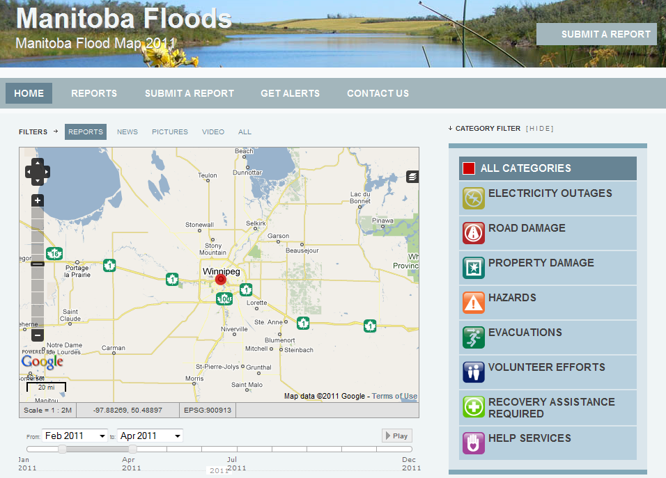
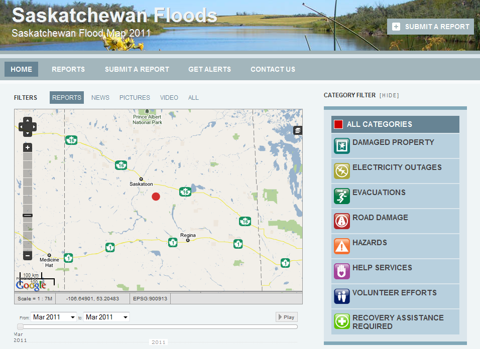
  • Collaborating withUshahidi friends on the on mbfloods.ca and skfloods.ca initiatives
  • Organize and support Random Hacks of Kindness 3.0 for June 4/5, 2011.
  • Mapping the world with Stand By Task Force and CrisisMappers communities.
  • Fostering Mozilla Drumbeat projects. There is a real opportunity to connect Volunteer Technical Communities to projects within Drumbeat. For example, P2PU.org, Webmademovies and Universalsubtitles.com offer resources which could assist these global communities. But, mainly I am fan focused on the existing projects supporting an Open Web.
  • 20Mar

    Canadian Mappers Prepare for Spring Floods

    Ushahidi Mappers in Canada!

    (cross-posted on the Ushahidi blog)

    Be still my prairie girl heart. Laura Madison and Dale Zak spent the winter preparing for the Spring floods in Manitoba and Saskatchewan. Extensive flooding is expected in both the Red River Valley and North/South Saskatchewan River regions. This is the first time that Ushahidi has been used to prepare and to report the Floods in Canada. In fact, both maps are the first time that full scale Ushahidi maps have been prepared as part of the citizen reporting and digital volunteer response in Canada. There are Canadian university classes learning Ushahidi and CrisisCamp Toronto conducted an Ushahid beta test in February 2011. Laura is very active in the Ushahidi and Stand-by Task Force communities. Dale is active in the Ushahidi team. Each of us has mapped events around the world. And, we are delighted to see mapping come home.

    How to help

    Ushahidi is an open source project. There are three types of help required: Mappers, Developers, and Digital Volunteers. Maps are community-driven crowdsourcing. In the coming weeks, the needs will change daily or hourly. This is the beauty and curse of volunteer digital response. Both leaders have been in contact with official responders. However, at this time, their efforts are for citizen response and collaboration.

    MBfloods and SKFloods maps allow for reports to be filed by webform, Ushahidi app, iphone, android, or email. Maps allow for various layers of useful open data to be added. People will be able to add news reports, pictures and videos. Maps evolve depending on the community use. So the needs will change over time. The work they have done is fantastic. Bring on the crowd! People are needed to file reports, coordinate mapping teams for about 2 weeks. Laura and Dale will be coordinating this adventure via Skype. I am sure that the great mapping communities may lend a hand. If you are an individual volunteer or are part of a volunteer technical community, please consider contacting:

    Contact Dale for Saskatchewan: skfloods AT gmail DOT com
    Contact Laura for Manitoba: mbfloods AT gmail DOT com
    Participate in the joint Skype channel: Add Laura (organization9) to get started.

    Types of help required:

    Preparedness
    Laura has added layers for the Manitoba RCMP and Manitoba First Nations. She would like to add more layers. Mappers most welcome to churn out KML/KMZ files. She also needs some PHP help and Ushahidi expertise.

    Volunteer Recruitment and Training
    Both maps will need digital volunteer teams to support the mapping. The types of content you will be adding is geo-location, media monitoring (mainstream, twitter, facebook), and handling the various streams of online reports (webform, apps and email.)

    About Ushahidi

    To learn more about Ushahidi, see recently released Ushahidi manual , created by the lovely crisismapper Anahi Ayala Iacucci. It outlines how to get started with Ushahidi and implement a successful deployment. Maps need people and process to work. This Ushahidi Practical Considerations is also very helpful.

    Feel free to contact me as well (heather at textontechs dot com) if you want more information or want to be connected to Dale or Laura.

    (Note: I am involved a friend, a Canadian, a serial volunteer and chronic Ushahidi mapper fan club member. This is not a CrisisCommons or CrisisCamp initiative.)

    Heather L.

    10Mar

    May the Stream Be With Us: My Virtual SXSW Sessions

    Virtual participation for geek, technical or social events helps the sting of not being able to attend in person. While it can’t completely fill the void of shared, human interaction, at least you can potentially watch a stream, catch a liveblog or even find a new person to follow who inspires you.

    photo by Tolmie Macrae

    South by South West – Interactive starts tomorrow. Every year I make a wish list of sessions that I would either attend or research. Then, I seek out the content and presenters before, during and after the events. It also gives me a chance to support some friends and thought leaders from afar. The list below is an eclectic mix of interests. There are folks from CrisisCommons, Ushahidi, OpenStreetMap, UN Global Pulse, Frontline SMS, Movements.org, NPR (Andy Carvin), Mozilla, P2PU, Toronto friends, and more. I know that I have missed some good people and welcome the tips. Also included are topics that perked my interest or topics that I know friends or family members research.

    As you can tell, I would need to be cloned multiple times over to virtually monitor all of these sessions. And, put the rest of my scheduled activities on hold. Most of the sessions have hashtags and might have streaming. Last year I was able to cobble participation together for 10 sessions. I am mainly following #sxswgood for my Technology-for-Social-Good @ SXSW fix.

    The Virtual SXSW Schedule (subject to whim and edits)

    Austin Time translator – all times in CST Standard time zone: UTC/GMT -6 hours
    (Note: DST starts on the weekend. On Sunday, switch to UTC/GMT -5 hours)

    What time is it for me?

    Friday, March 11, 2011

    14:00 Lessons Learned from the Arab Spring Revolutions – Susannah Vila (movements.org)

    14:00 Fireside Chat: Tim O’Reilly Interviewed by Jason Calacanis

    14:00 Rebooting Iceland: Crowdsourcing Innovation in Uncertain Times

    15:30 The Future of WordPress

    17:00 The Singularity is HERE (cousin’s research area)

    Saturday, March 12, 2011

    9:30 Putting the Public Back in Public Media Andy Carvin
    9:30 Federating the Social Web

    11:00 Agile Self-Development
    More details.

    11:00 We Are Browncoats: Leveraging Fan Communities for Charity Serenity!

    11:00 Seed & Feed: How to Cultivate Self-Organizing Communities (New Work City – for @camaraderie)

    11:00 Flattr w/Thingiverse, Readability, Demotix: Rewarding Creators and Crowdfunding
    #FlattrSXSW

    12:30 Time Traveling: Interfaces for Geotemporal Visualization

    12:30 Mobile Health in Africa: What Can We Learn?
    Josh Nesbitt Frontline SMS #AmHealth

    12:30 How Social Media Fueled Unrest in Middle East New York Times

    14:00 Keynote Simulcast: Seth Priebatsch Gaming!

    15:30 Humans Versus Robots: Who Curates the Real-Time Web?

    15:30 The Behavior Change Checklist. Down With Gamefication Aza Raskin

    15:30 Real World Moderation: Lessons from 11 Years of Community
    Metafilter

    15:30 Social Media Data Visualization: Mapping the World’s Conversations

    16:00 Sleeping at Internet Cafes: The Next 300 Million Chinese Users

    17:00 All These Worlds Are Yours: Visualizing Space Data

    17:00 Web Anywhere: Mobile Optimisation With HTML5, CSS3, JavaScript

    Sunday, March 13, 2011

    9:30 Radical Openness: Growing TED by Giving it Away

    9:30 One Codebase, Endless Possibilities: Real HTML5 Hacking

    11:00 Hacking the News: Applying Computer Science to Journalism

    11:00 The Future of Philanthropy: Social Giving Takes Off
    #socialgiving More Details

    12:30 Fail Big, Fail Often: How Fear Limits Creativity

    12:30 Influencers Will Inherit the Earth. Quick, Market Them! Sloane Berrett

    12:30 Urban Technology on the Dark Side

    15:30 Nonprofits and Free Agents in A Networked World Beth Kantor

    15:30 Paying with Data: How Free Services Aren’t Free (Privacy, NYT, Stanford)

    Monday, March 14

    9:30 Tweets from September 11 Schuyler Erle

    9:30 Method Tweeting for Non Profits (and Other Players) Geoff Livingston

    9:30 Machine Learning and Social Media

    11:00 SOS – Can Citizen Alerts Be Trusted? Patrick Meier, Chris Blow, Robert Kilpatrick and Karen Flavell

    11:00 Worst Website Ever II: Too Stupid to Fail

    11:00 The SINGULARITY: Humanity’s Huge Techno Challenge
    (My cousin’s research area)

    11:00 Naked Dating: Finding Love in 140 Characters or Less Melissa Smich and Jeremy Wright

    11:00 Cryptography, Technology, Privacy: Philip Zimmermann, Inventor of PGP

    12:30 NPR’s API: Create Once, Publish Everywhere

    15:30 Mozilla School of Webcraft @P2PU John Britton

    15:30 Voting: The 233-Year-Old Design Problem

    16:00 How to Offer Your Content in 100 Languages Featuring June Cohen of TED and Seth Bindernagel of Mozilla

    17:00 DIY Diplomacy: Designing Collaborative Gov Noel Dickover

    Tuesday, March 15

    11:00 Creating a Social Hackathon for the Good – Justice League Style

    12:30 Wikileaks: The Website That Changed the World?

    12:30 How Governments are Changing Where Big Ideas Happen Ian Kelso, Interactive Ontario

    15:00 Next Stage: Bike Hugger’s Built: A Series of Talks by People Who Create

    15:30 Interoperable Locations: Matching Your Places with My Places Kate Chapman

    15:30 The Wonderful Things in Internet of Things

    15:30 Techies Can Save the World, Why Aren’t They?

    17:00 Bruce Sterling, closing speaker

    17:00 Voices From The HTML5 Trenches: Browser Wars IV Mozilla, Google and more

    Brain infusion pending.

    Heather

    5Mar

    Maps and Mappers

    Do something. During the CrisisCommons response to Haiti, I learned about the Crisismappers network. When the Chilean earthquake occurred, our CrisisCamp Toronto team got a crash course in Ushahidi and crisismapping by creating training materials while we learned how to map. We also volunteered for the Pakistan floods using the same tools and community networks. I became hooked. Geo-locating situational awareness and potential needs to provide context to humanitarian response continues to evolve. I am a mapper-in-training (MIT) and a serial volunteer.

    In October 2010, I attended the International Conference of CrisisMappers. The calibre of organizations, academics and volunteers inspired me to join the newly formed Stand-by Task Force (SBTF). The SBTF is a collective of highly skilled, diverse people from around the world who can be activated to respond. As George Chamales of Konpa Group likes to say: a map is only as useful as the process and people to make it happen. It is hard, iterative work to map. But, the rewards mean contributing to a new, visual response. In January, I volunteered with the SBTF monitoring the Sudan elections with sudanvotemonitor.com. I spent time working with the geo-locating team.

    I could spend a few years learning and still not be an expert. Everyone starts somewhere. While I have volunteered with Ushahidi and maps for a year, there are many layers. The CrisisCamp Toronto team is modeling and testing maps as a volunteer offering. We created Snow in Toronto. I applied the SBTF methods and cross-trained my local peers on how and what to map using the best practice templates and processes.

    Maps

    Mapful. The last weeks included large scale responses for the Standby Task Force and CrisisCamp. Digital volunteers from many groups have answered the call to action.

    New Zealand – eq.org.nz

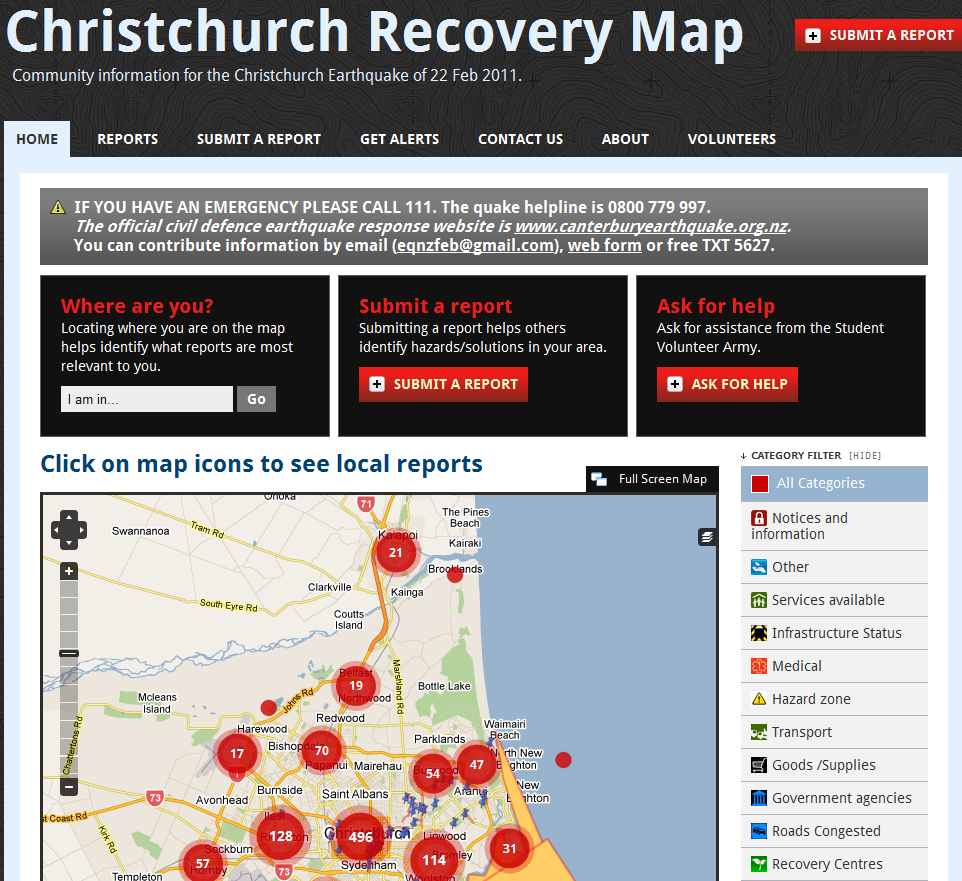
    Monday, February 21st was the end of a long weekend. Upon checking my twitter stream around 20:30, I learned about the earthquake in New Zealand. I logged on to skype and began collaborating with people from around the world for 8 hours straight. We activated the Stand-by Task Force to assist with the initial response and training. I was given the honour to chronicle the experience on the Ushahidi and CrisisCommons blogs: Launching eq.nz.org for the New Zealand Earthquake.

    In 12 days, the CrisisCamp New Team and friends have filed 1,355 reports and 10 layers of information. Their work has been chronicled on the CrisisCommons wiki and blog.
    All the NZ folks like Tim McNamara, Robert Coup, Nat Torkington, Gavin Treadgold and hundreds of volunteers are changing the face of emergency response in NZ and inspiring people around the world.

    Libya
    The Stand-by Task Force was activated this week for a special project for the United Nations – Office for the Coordination of Humanitarian Affairs (UN-OCHA). This historical action involved crisismappers in the humanitarian response. I joined the SBTF deployment team and began research social media resources and mapping. Four days later we have hundreds of reports verified and continue to volunteer. This effort included many diverse groups – CrisisCommons, Humanity Road, CrisisMappers, Google Crisis Response Team, NetHope and OpenStreetMap. Patrick Meier, Director of Crisismapping at Ushahidi, and Sara Farmer, Chief Platform Architect at UN Global Pulse blogged about the the Libya response. The map is not publicly available at this time due to the sensitive nature. Mappers do no harm, we just want to help. In time, it will be available. Volunteers are most welcome. You can contact the Standby Task Force.

    Digital Mappers

    Digital volunteers from the various Volunteer Technical Communities (VTCs) are involved in crisismapping. There are hard-core geo mappers like the OpenStreetMap and the Google Earth folks. And, there are groups like CrisisCommons, Crisismappers, and Humanity Road who provide surge capacity and often focus on situational awareness and research from social media, media and official sources. Add to this, the Ushahidi development team and other technical volunteers.

    Who are these digital mappers? Well, they are doers. A mapper doesn’t want to talk for hours about doing, they just do. It takes a new volunteer about 4 hours to wrap your head around the process and begin to really dig in. The SBTF have worked on a number of deployments and are very open to new members. We are the people who map for 3 hours at night instead of watching tv. We are the people who wake up early before work, log into skype and add a few reports to the map. We map at lunch. We are the people who may drop everything to map for 4 days. We are communicators and friends. And, we believe that a map can and does change the world. Every day I am more and more honoured to call myself a mapper. While it might not show immediately that we are making a difference, it will in time. Iterative change starts with a few hours and a few dedicated people who want to make a difference.

    Heather

    18Feb

    Social Media in Canadian Emergencies – CrisisCamp Toronto

    The CrisisCamp Toronto team has been working hard to prepare for CrisisCamp Social Media in Canadian Emergencies. This morning I was delighted to receive some great response from the IAEM – Canada mailing list. Our goal is to connect the spirit of Canadian startup innovation, internet savvy and emergency managers.

    When: Saturday, February 19, 2011 10am – 5pm Where: University of Toronto, OISE 4th fl

    Here is a list of Communication channels to participate during CrisisCamp Toronto.

    LiveChat- Social Media in Canadian Emergencies on Saturday, February 19, 2010,
    14:00ET, 11:00PT for one hour

    We’re hosting a tweetchat (live chat on twitter.com). If you search twitter.com for #CSMEM you can follow all the comments. If you have a twitter account, please use the hashtag #CSMEM and add your province code. (Eg. SK, NFLD). This session will be held in both English and French. We will have translators to help. It is our hope to host these regularly. Our American friends use the #SMEM hashtag.

    Twitter hashtags

    Follow us on Twitter : @crisiscampTO
    #CSMEM
    #CSMEMchat

    Also see: @crisiscamp, @crisiscommons and #SMEM

    Liveblog

    I saw a demo of Scribblelive at Hacks/Hackers this week. I think it is a great fit for CrisisCamp Toronto’s event. It is all set up and ready to start posting content tomorrow morning. I also downloaded the free Iphone app. If it works for this event, I’ll be recommending it for more events in the future both in Canada and globally.

    Ustream

    We will try to stream and record the morning sessions. This will help other folks learn. Again, it will be active around 10:00 ET on Saturday.


    Live Videos by Ustream

    Schedule for the day

    10 – 10:30ET – Introduction
    10:30 – 1:00ET Morning session

    Education Stream
    We will run these three sessions, three times. You can pick which one you want to attend.
    1. Emergency Management 101/Emergency Management in Canada
    2. GIS/Mapping 101
    3. Social Media 101/CrisisMapping 101

    Dev and Tool Testing Stream
    *Crowdmap/Ushahidi 101- test case and cross-training
    *Ushahidi small code features – TBD

    Other activities:
    *Prep for #CSMEM Twitchat
    *Canadian Virtual Volunteer Team planning: help us brainstorm credentials and organization for this idea.

    1:00ET Lunch

    Afternoon: 1:30 – 4:30pm
    2:00-3:00ET – Live chat on Crisis Commons and Social Media in Emergency Management (skype – Heather Leson – Twitter #csmem)

    1:30 – 2:00 Brainstorming ideas with Melanie on CrisisCommons Canada activities
    3:00 – 5:00 ET

    1. Project Demos
    CrisisCamp Toronto wants to pick a project to work on. Demo your project idea in 5 minutes, then we will vote
    2. Project Planning
    We will build out the project requirements and next steps
    3.Ongoing work playing with tools will continue in the other rooms.

    5pm Event complete.

    Join our CrisisCamp TO Mailing list

    4Feb

    Snowmap and upcoming Social Media/Crisis Management Events

    Mapping and strategies for Social Media in emergencies/crisis in Canada are new concepts. I am working with the CrisisCommons Canada team to bring crowdsourcing home. We have a few events and beta tests on the go. This is the beginning. I believe in the power of Internet communities and an open web making a difference in our country and the world.

    Snow in Toronto – Crowdmap.com Beta

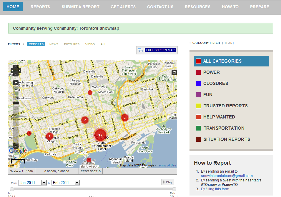
    CrisisCamp Toronto set up a map to help Toronto folks report about this week’s snowstorm. We decided on Monday night. Melanie Gorka, Brian Chick, David Black and I built out the map, process and created a press release. Using the format of the Crisismappers.net Standby Task Force, we took the best practices and fit them to our team. We reached out the the CrisisCamp Toronto communities and our own networks. In 5 days, we had 42 posts, 620 unique visitors and about 30 re-tweets. Our goals were to test our process and create a Canadian proof-of-concept. We will prepare an After-Action-Report with the full results. The response we received from Ontario, Toronto and Canadian government officials and the media was fantastic. We are working on preparedness strategies with our partners. Stay tuned for more initiatives. Here is our Snowmap:

    CrisisCamp Toronto is hosting a Social Media / Emergency Management event on Feb. 19th

    We invite Emergency Managers and New Media Technologists to join us and share their skills. This SM/EM (Social Media/Emergency Management) event is to help our community be more prepared and to build partnerships between Canadian emergency management, NGO, project managers, software developers, technical experts and social media folks. This includes GIS/OSM training. There is a second stream of activity to make and test tools.

    As well, we are taking project submissions. Each person will present their idea. Then, the group will vote on the project and begin to brainstorm on the next steps. We want to build solutions for Canadian crisis and emergencies.

    On a personal note, I am super excited that Sara Farmer of UN Global Pulse and the CrisisMappers team will be joining us. She formerly ran CrisisCamp in London. The CrisisCommons community is a global family. We aim to exchange ideas. It is a great chance to learn from someone who has been working on some amazing projects.

    Sign up for the event.

    Random Hacks of Kindness – Survey and Canadian plans

    All participants of Canada’s first Random Hacks of Kindness event received a survey this week. The RHoK team is gearing up for 2011. Watch this space for announcements. RHoK Global encourages partnerships with universities for upcoming events. We found great success partnering with University of Toronto. And, we can’t wait to share with other cities.

    19Jan

    Bring Crowdsourcing Home – Crowdsourcing Fire and Floods

    It is a goal to bring Crowdsourcing home in 2011. Our CrisisCommons Toronto team attended a meeting with the Ontario Government, Ministry of Natural Resources on January 18, 2011. It was an honour to have our first official Canadian provincial government meeting.

    I presented this overview to attendees. Crisismapper volunteers from Russia and Australia provided some input with their lessons learned for fire crowdsourcing implementations. This is the power of global volunteer technology communities. We had a great discussion about barriers in remote regions, mapping techniques and government policy. Over 75% of forest fires reported in Ontario are by the public. We intend to use the latest tools available to share with mapping visual information.

    Officials were very receptive to continuing our discussions. I will post the next steps as they evolve.

    Heather

    © Copyright 2016, All Rights Reserved