CrisisMappers

13Mar

Map Library

In my first year of university at Carleton University, I found myself drawn to the Map Library. I would spend hours scouring maps. That Christmas my gift to my grandfather was a series of photocopied maps and town directories of Western Ukraine (Bukovina, Chernivtsi) for a 100 year period. We read through town names together. It is a beautiful memory of how much the maps and data can be so personal for us.

Today I hosted Max Richman on a Community Call to share his Open Maps talk which he previously presented at Open Data Day DC. (His slides). In our chatting, which spilled over to twitter, we started to collect a list of map books that we love and that we recommend. I have too many that I haven’t read, but some that I have.

Here are some of the ones suggested:

stack of map books

What’s in your Map Library?

In an effort to keep tracking, I created this open Hackpad to build a fun Map Library. Recommendations welcome.

5Mar

A Forward Looking Board with HOT

The Humanitarian OpenStreetMap Team community membership has re-elected me as a Board member. I am delighted.

The announcement on the OpenStreetMap wiki.

We have a strong mandate and an engaged membership. These past few weeks have included many discussions about the role of a Board and the changes that we, collectively, need to make. It is a true honour to be charged to continue support HOT’s mission.

On that note, I found this Mckinsey Report on shaping a Board. If you have any resources on how to help a new Board, being a Board Member and organizational change in the Humanitarian and Open Source fields, please do send these my way.

“Governance arguably suffers most, though, when boards spend too much time looking in the rear-view mirror and not enough scanning the road ahead. “

The McKinsey Report on Building A Forward Looking Board.

To my fellow Hotties, thank you for the trust to continue my supportive role.

19Feb

Open in Protest and Crisismapping

Protest and Crisismapping are intertwined with voice. I think conflict mappers, videographers, data analysts and storytellers are incredibility brave and important to our future. But, local knowledge, local language and local context must guide decisions. There are some tough questions to ask about what should be openly shared or why not have something as open data?

Videos, imagery layers, pictures, reports, maps, stories and datasets are used to both give voice and collect evidence on human rights violations. From the comfort of my home in Canada, I have not lived in times of civil war in Syria. I have not stood in the freezing cold in Kyiv alongside protestors. We can, in solidarity, write about it, share links online, become crisismappers (Digital Humanitarians), petition our governments, but for the most part, we are a world away. No matter how connected we are via the Internet, we can be equally disconnected.

On Protest

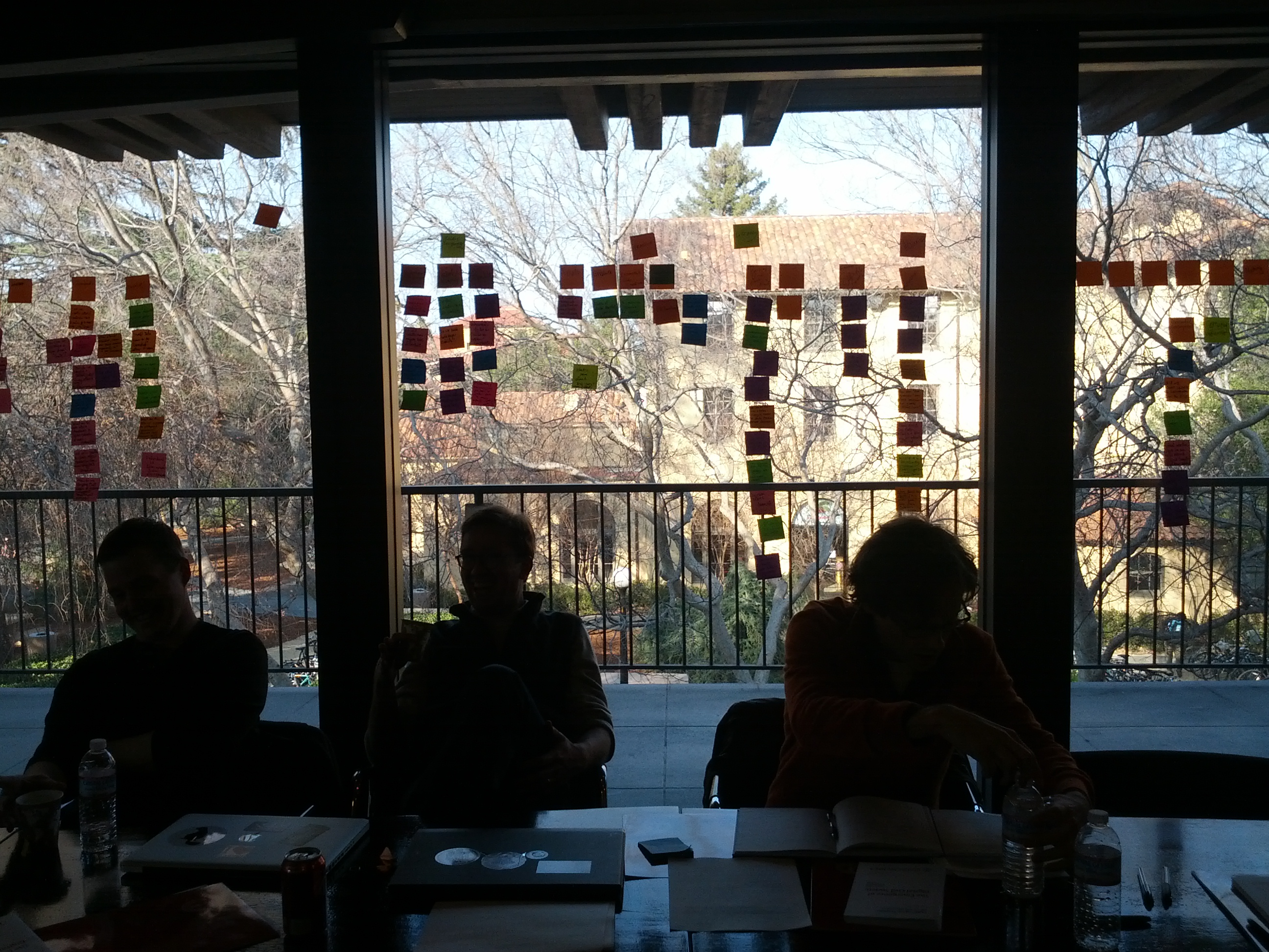
At Info Activism Camp, I joined the protest salon. Speakers discussed their activism in various global contexts. You can download and watch the discussion, read the protest mini-magazine and listen to the protest soundtrack.

There is a big difference in marching down to Queens Park (Toronto) vs. trying to feed your friends in Taksim Square in Istanbul or keeping your friends safe in Brasil. The stories of people’s lives, their efforts to protect rights and collect evidence gave me a profound backdrop for how I observe the world. The videos and livestreams from Ukraine tell a story of another country’s people in protest. There have been over 3 million views for the video I am a Ukrainian. The first time I watched it I cried. On the second view, it hit me how powerful video and Internet remains. Then and now: I fear for their safety.

Crisismapping Syria

Talking with Brown Moses, Women Under Siege Syria, or Syria Tracker, I have come to learn about the tenacity of humans and potential of digital forensics. These projects and their leaders are the forefront of asking questions: what should be published or not published. Their verification methods for video, pictures and reports are mapping new ground. They work very closely with people in the affected regions alongside global helpers. Brown Moses is meticulous in his analysis of social media (how Facebook is destroying History), weaponery and videos. Lauren Wolfe has built the Women Under Siege project to give voice to women who suffer brutal violence in times of war. Her methods in research, journalism, online engagement and verification highlight how a map can be one corner of a larger, more extensive project. Both the Syria Tracker and Women Under Siege teams do not publish all the details outright. They review, debate, curate and anonymize. Brown Moses has a unique talent of identifying and teaching methodology. These digital skills show us how crisismapping has evolved. Evidence and data collection happens in real-time. People are using these tools to make decisions. This is the nature of data and information. And while data can and has been used as a commodity and a power device, these types of projects show focus on those we serve – the survivors and the affected.

From Aleppo


“We struggle with this challenge, balancing between the imperative to do no harm with the virtues of transparency and openness.”

All of us seek information for evidence or even to help guide humanitarian decisions. This week First Mile Geo released it’s detailed case study on Aleppo complete with a set of open data. Collecting data about bakeries, locations and, potentially, movements in a conflict zone and then releasing that data will surely bring on questions. But, the First Mile Geo is already asking them with us:

Matt McNabb: But the principles underlying open data have their limits in conflict-affected areas, where the contest of information can –and often does –emerge more frequently to support actions that may have a deleterious effect on citizens’ safety or well being. Perhaps obvious to say, data in war can be a dangerous thing.

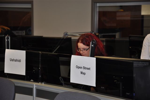
I firmly believe that the next future of open data is collected by citizens for whom the data is about rather than only stored in a government or business sanctioned data portal. We need both. The success or failure of Open Data will happen in the “majority world” (or as others call it the Global South or Developing world.) It is great to have Open Data events in over 110 places around the world on Open Data Day. One day is a start, but I think the penetration of Open Data will only happen if it follows the lead of OpenStreetMap. People need to be involved at a local level. Simply put: people don’t trust government and want to be part of the process (have agency over their data.) So, it is with this that I think methodology of First Mile Geo is at the forefront of combining offline community engagement (paper and pen) tied with maps to build local help. Crisismapping shows us that the raw questions alive in the field and being shared openly by folks like the First Mile team, Brown Moses, Syria Tracker and Women Under Seige. We need to consider what they have learned and how it can apply in conflict, crisis or developing areas.

Also see the Wired article on Mapping Aleppo

****
And now for more questions:

What does it mean to be “open” and “collaborative” in a conflict or crisis zone? What does it mean for protestors? When does the affected population get a voice in what video/picture or imagery gets used and for what means? What are the new ethics for the digital crisis? In January of this year, I joined a round table and said: we need an imagery code of conduct (for satellites and drones). I advised them that we can’t wait for 4 years of research. This is happening now. People are being affected now and digital humanitarians are having these discussions now. I shared some of the example discussions we have had within the Humanitarian OpenStreetMap Team. As security analyst Bruce Schneier rightfully points out, location is being used and we need to prepare for the new level of privacy and security discussions. While we race to share, collaborative and open up information, we need to build stronger data guidelines and data training.

Please go to: RightsCon and Responsible Data Forum to talk among peers. I’ll be watching via the Internet trying to catch snippets.

10Feb

On the Humanitarian OpenStreetMap Team Board

For almost a year, I’ve had the honour to be a member of the Humanitarian OpenStreetMap Team Board. HOT is one of the most important Digital Humanitarian /Crisismapper communities. As a community advocate and organizer, I joined to support and be in service of these efforts. A Board member serves the strategic interest of the organization and her members. Today I ask the HOT membership to consider renewing my Board Membership so that I can continue to collaborate and help HOT grow.

For my fellow candidates: HOT is a young organization. Being a HOT Board Member often required more than 10 hours a week. If you are nominated to join the board, you should be prepared to contribute this level of time. I’m writing this to help outline what I think the HOT Board needs to do in the next term.

Boy and the world image

When I joined the Board, I began researching Board best practices and reviewed many other organization’s Board composition, bylaws and strategic plans. I also asked colleagues from other organizations what makes a successful board. I determined that I could contribute work on fundraising, communications, strategy and outreach. These are items that I felt were missing from HOT’s strategy.

My first board term involved more organizational development issues, which delayed my original goals. HOT is a Working Board. But, there are some differences between what a Board does and what items are for Operations. This continues to be a growth opportunity for HOT. A Board ideally should not be involved in the day-to-day operations operations of the organization. Some examples include: staffing decisions, receipt management for projects, and HOT activations. I think it is important to also distinguish the Board, Operations and what it means to be a valuable contributor/member of the community. Every organization needs these components, but each is often its own entity.

By definition, a Board Member key role is to support the strategic growth and ongoing success of an organization. The following types of skills would be needed among the composite board. Every individual on the Board brings different skills, so consider this a sketch:

  • Networks (Fundraising, Humanitarian)
  • Technical Expertise
  • Legal Knowledge
  • Financial Acumen
  • Business and Organizational Development Strategy
  • Fundraising and Communications Strategy

The HOT Board should focus on the the above noted tasks to contribute to the success of the whole project.

Some Resources:

For friends of HOT, I am collecting resources on Boards and how to help shape with examples. Please do share any resources on Board leadership or Board Best Practices. This is a journey and I am learning as fast as I can. (Thank you in advance.)

On this topic, I want to thank Aspiration Tech gifting mentorship on the Board journey.

  • Chronicle of Philanthropy
  • Plone: (an example of a “Working” Board)

    “This is a working board. Be ready to regularly take on and complete responsibilities for board business.

    The board writes no code and makes no development decisions. It is much more concerned with marketing, budgets, fund-raising, community process and intellectual property considerations.”

  • Open Stack (Board example)
    “The Board of Directors provides strategic and financial oversight of Foundation resources and staff.”

(Photo by me: San Francisco, February 2014)

24Jan

Sticky Ideas

ushahidi teamwork

….And then we broke out the sticky notes to make ideas dance. We all have been there. You are in a room, your feet itch, and your mind is waiting: If only we could just break out the sticky notes to collect, flush and organize our thoughts. It is so second nature to any event I run and any event I participate. My mind goes to the technique. How can we make a world of bright people across disciplines sing like a choir on mission? Well, for those of us who have participated in Aspiration Tech events, we are in the “sticky way“. I like to call us Gunnerites. We are the converted who use this methodology to help each other move forward.

Gunner Listening

Gunner is a friend and mentor. I’ve had the awesome honour to participate and learn in his events for over 4 years. Each time I glean another strategy or technique to add to my toolkit. When I think about the rooms I’ve been in from Mark Surman’s house to the World Bank to a Fort on the coast of Lamu (Kenya), I reflect on how Gunner helped large and small rooms of people get to the heart of conversations and ideas. He does it modestly and with such adept skill that you often don’t realize the hand of excellent execution. The results truly highlight the value of participatory sharing for learning and events.

wall of ideas

Yesterday I had the honour of participating in an idea charrette at Stanford University. My role as a Board Member of Humanitarian OpenStreetMap was to provide insight into real world data ethics challenges that Crisismappers face. We used this methodology to help a very diverse room get cracking on great ideas. Thanks Lucy and Gunner.

******
Aspiration Tech and the engine room are hosting a Responsible Data Forum. You should go if you are in the SF area. And, if you are looking to join a great team of folks who make a huge difference in many non-profits, do apply for a Communications role at Aspiration.

(Photos from events: Ushahidi team meeting, Lamu (Kenya) (January 2013) and Data Charrette, Stanford University (January 2014))

21Jan

Every interaction is a gift

When I think of value in Tech 4 good communities or any other community / network, the core value I rest my mind on is: every interaction is a gift. This means every map edit on OpenStreetMap, every commit on github repo, every edit to translation set, every event organized/attended and every voice on a community hangout or mailing list. As community and programme managers, we aim to help people get involved. This is a one by one – very personal connection. This is especially true for those of in the Digital Humanitarian Network (umbrella of communities) or Crisismappers Network and more. These communities exist by the hub and spoke model. Each of us believes (to some degree) that we are incrementally changing the pace of humanitarian aid by connecting and sharing.

A few years ago (way before I changed up my career and volunteer paths to Tech 4 Good), I became an avid reader of Chris Brogan and his frequent co-writer, Julien Smith. At first it was to learn better marketing skills for my tech job at Tucows Inc., but soon I realized that I had virtually met people who understood the qualities and growth paths of people like us. Trust Agents really highlighted this for me.

Anyone who has ever gotten a “here’s a link I thought you might like” or “I’d Like to introduce you to x” email from me knows that I live by Chris’s network simple formula:


Be helpful + meet helpful people + connect really helpful people = potential for future amazingness.

Chris has a weekly newsletter (selly sell: subscribe for it). It is my Sunday cup of coffee to really consider our craft. This week his post really resonated with me. With his permission, I am quoting the simple formula and some key guidelines. Happy building.

BUILD A HELPFUL NETWORK

(Chris Brogan)

1.) Be open to connecting with anyone. You never know.

2.) When introducing others, ask first privately if you can make the introduction (lots of times, people introduce me to others that I can’t much help, for instance).

3.) Upon meeting someone new, think of ways you can help them. I promise this is MUCH more useful than thinking of ways they can help you.

4.) Set calendar reminders or ANY other method to keep in touch with people on a semi regular basis. Cold networks don’t help.

5.) Connect great people in your network together. It’s always greater than the sum of the separate parts.

IMG_1289

(Photo taken in Venice, Italy by moi)

Thanks for Sharing, Chris.

11Jan

Open Badges in a Crisis

Recruit, Track, Assign, and Give thanks. These are volunteer management steps in the digital age. Many organizations are looking at ways to train, incorporate and support digital skilled people in their workflows. The Crisismappers Community and the Digital Humanitarian Network (DHN) highlight the convergence of new technology/smart design like open badges, digital community networks and making. How do we get the next 10, 000 participants in a community? How do we manage the surge of new digital humanitarians and make it a valuable experience?

At Mozilla Drumbeat in 2010 (precursor to Mozfest), I joined the first ever Open Badges hackteam. We spent the weekend talking and building around the idea of credentials. Fast forward 4 years, I joined a Mozfest team in the Emergency Hack Lab. We brainstormed on a technical workflow for badging using the scenario of Hurricane Sandy.

Uchaguzi community badge 3

Cracking crowdsource or brainsourcing has been a mighty task that many are working on. We as organizers know that anyone who wishes to get involved is a gift for community. We know that there are small asks and big tasks for engagement. Tackling digital knowledge skills with surge support can be a full-time job during an emergency. We all have networks and there are a number of strong community groups or NGOs that are building better methods to train and support digital humanitarians. Last year I lead a digital community mapping effort called Uchaguzi for the Kenya Elections. The Ushahidi designer, Jepchumba, created badges for all the participants to use. This was to build solidarity and give thanks. Crowdcrafting (micromappers) was used during the Typhoon Haiyan (Yolanda). I wrote a bit about ‘hacking’ during the Typhoon response mainly due to the sheer volume of emails and conversations.

Building Use Cases

We could use Open Badges for UN OCHA/Noun Project icons (emergency standard) Digital Humanitarians and emergency wayfinding. Earlier this week I pitched it on our Emergency Hack Lab call, including our partners at Geeks without Bounds.

Humanitarian OpenStreetMap and Open Badges

Digital humanitarians need to build trust and get thanks. Open Badges across the various communities enables standards but also gives recognition and thanks. The DHN really helps digital volunteers join specific skillset groups. The ideal is that the volunteer engagement occurs via these individual organizations. DHN exists to connect people to real actionable tasks to solve real world problems.

Example:
The Humanitarian OpenStreetMap had over 1600 mappers do over 3 million edits for the Typhoon Response. We are part of DHN. With the help of Imagery to the Crowd and many other partners, the community received imagery which was added to the Task Manager. The task manager organizes the imagery into tiles and helps digital mappers coordinate. They sign in with their OSM account.

How easy would it be to add an HOT OSM Badge into this process?
There are two core goals with this concept: credentials and thanks. HOT participants could use these for their social media or linked in profiles. Or, Open Badges could be used on the Task Manager or OSM Wiki. As a HOT board member, I continue to think about how to help thank the virtual, global community. Open Badges allows us potentially solve a gap.

Learn more Haiyan response from my fellow HOT OSM Board member, Harry Wood. (podcast)

Murmur + Wayfinding:(SMS solutions)

Ever since Hurricane Sandy I have been thinking about the power of Wayfinding during an emergency and how to connect and map community responders. Jess Klein, Creative lead of Open Badges has been a big inspiration on this journey. As well, Daniel Latorre of Wise City worked with Occupy Sandy communities to design and sign.

It struck me that Murmur plus Wayfinding plus Open Badges might be a way to connect those amazing ‘first responders’. While they may not be associated with formal organizations or NGOs, there are some community responders who make a huge difference in the field. Jess has written about this importance in response to Hurricane Sandy.

[murmur] is a documentary oral history project that records stories and memories told about specific geographic locations. We collect and make accessible people’s personal histories and anecdotes about the places in their neighborhoods that are important to them.

Around Toronto there are Murmur signs. You call the number on the sign and you get a poem or story about the space or area. It is sheer magic in community and public spaces. Well, if Wayfinding is amazing to help people design and coordinate and Open Badges assigns and gives thanks, why not add an SMS number to sign up to volunteer, get SMS tasks and plus, a Badge. This idea about SMS task management is not new, but is missing is the pieces of thanks with Open badges.

Example: A Wayfinding sign is designed using the UN OCHA/Noun Project Label, but also includes and SMS number. This SMS number ties to the volunteer management choice of the community plus Open Badges. The NGO could use any number of SMS apps to help manage the volunteers and link them to an Open Badge process. Some examples include Frontline SMS, Medic (sim apps), Swara (Interactive Voice Response tool) or many others. The goal here would be to recognize mobile plus open badges as the way forward, especially in the majority of the world.

This idea needs more work, but you get the picture. The power of Open Badges during a Crisis is full of thanks.

****

There is much more thinking and hacking to happen, but it is an exciting journey.

Join the next Open Badges call

3Jan

Canada: Open Data for Development Challenge

The day is finally here! After years of building open community connections with governments, each one of us can look to this a turning point. The Canadian government, Department of Foreign Affairs, Trade and Development, is officially hosting an event inviting the open communities to join them in a 2-day hackathon, er, Open Data for Development Challenge. There have been many hands and minds to make this possible. The government has been very keen on listening and observing Open style events globally. This is likely the first of many Challenges for Open Data in Canada. They are taking idea submissions until January 8, 2014.

Crisismapping background with DFATD (DFAIT)

Heather @ DFAIT

Since the Haiti earthquake, I’ve participated in a number of informal discussions with the government. They were keen to learn more about how open communities map during emergencies. In September and December of 2011, we had two meetings to learn more about each other’s work to build a common language. In February 2012, DFATD (formerly DFAIT) hosted an Open Policy day. Along with Melissa Elliot of the Standby Task Force, we pitched a Crisismapping simulation using OpenStreetMap and open data sets. This lead to the first ever Canadian government sanctioned CrisisMapping simulation in March 2013 with Humanitarian OpenStreetMap (Pierre Beland), Ushahidi (myself), and the Standby Task Force (Melissa Elliot and virtual SBTF teams). The sessions invited various levels of governments from different departments to observe our work.

This is a small window into bringing open communities closer to government data and cooperation for humanitarian purposes. I am more than certain that others have great stories about the road to opening up Canada.

***
The Open Data for Development Challenge idea that I am working on stems from the School of Data Expedition into Nigerian Extractive mining. I’m keen to learn more about Canadian company transparency for their work. This is the document I’m using to track datasets.

Hope to see you at the Open Data for Development Challenge!

Open Data for Development Challenge – January 27,28, 2014 (Montreal, QC)

You can register for the event (by January 10, 2014) http://www.open-dev-ouvert.ca/ (updated link)
(challenge submissions are due on January 8, 2014 via the same website)

Questions about the event should be directed to: opendata.donneesouvertes AT international.gc.ca

From the Announcement:

Do you want to share your creative ideas and cutting-edge expertise, and make a difference in the world?
Do you want to help Canadians and the world understand how development aid is spent and what its impact is?
Do you want to be challenged and have fun at the same time?
If so, take the Open Data for Development Challenge!

This unique 36-hour ”codathon” organized by Foreign Affairs, Trade and Development Canada will bring together Canadian and international technical experts and policy makers to generate new tools and ideas in the fields of open data and aid transparency and contribute to innovative solutions to the world’s pressing development challenges.

The event will feature keynote speakers Aleem Walji, Director of the World Bank’s Innovation Labs, and Mark Surman, Executive Director of the Mozilla Foundation. It will have two related dimensions:

  • Technical challenges that involve building applications to make existing open aid and development-related data more useful. Proposed topics include building a data viewer compatible with multilingual data, creating a publishing tool suitable for use by mid-sized Canadian non-profit organizations, developing and testing applications for open contracting, and taking a deep dive into the procurement data of the World Bank Group.
  • There is room for challenges proposed by the community. Proposals should be submitted through the event website no later than January 8th. Challenges will be published prior to the event, along with key datasets and other related information, to enable participants to prepare for the event.
  • Policy discussions on how open data and open government can enable development results. This would include the use of big data in development programming, the innovative ways in which data can be mapped and visualized for development, and the impact of open data on developing countries.

The international aid transparency community will be encouraged to take promising tools and ideas from the event forward for further research and development.

We invite you to register, at no cost, at: https://www.accreditationcanada.gc.ca/ODDC/accreditation.aspx as soon as possible and no later than January 10. A message confirming your registration and providing additional information about the venue and accommodation will be sent to confirmed participants. Please wait for this confirmation before making any travel arrangements. Participants are asked to make their own accommodation arrangements. A limited number of guest rooms will be available to event participants at a preferential rate.

To find out more about the Open Data for Development Challenge, please go to DFATD’s website.

(Note: content snipped from the civicaccess discuss mailing list)

19Nov

Community brainstorming: The world needs more Crisis Mappers

Every organizer dreams of that perfect mix of location and glue for their work. There is this moment that an event gells and you can breath. Running the International Conference of Crisis Mappers pre-conference training was a true pleasure. I curated 4 tracks: mobile/security, maps, data and knowledge. Then, I recruited some of the best talent both already in the CrisisMappers community and groups/areas that there were gaps. Thanks to all my fellow presenters, trainers, ICCM organizers, sponsors (Ihub and Ushahidi) as well as all the participants.

We did not take full notes for all the amazing sessions. There were 105 participants split across all the various areas. It was an honour to have long time community members and new folks blend to build. The closing session was a group brainstorm. (See the ideas captured below.) To be honest, we were super exhausted from jetlag and learning. Here are some of the key questions or statements that everyone had at the event – in analog form. While is it a stream of conscious list, I think it speaks volumes about some of the other gaps / opportunities that we need to discuss. It is a window into a time and place.

On a more personal note, Ihub and Ushahidi gave us an amazing space and food sponsorship to help make this day a success. It was great to have the community together in the place that really ignited the movement. ihub is also one of my favourite event venues. It has this pulse that brings people closer together in a casual way. It was perfect for a very mixed crowd to really bond.


What questions do you think we should be discussing? What are some of the conversations you want to be having?

ICCM COMMUNITY

Community

  • Create a forum for humanitarian innovation forum
  • How do we reduce duplication of the same work by different organizations?
  • How do we collaborate with each other more?
  • How do we open up the crisis mappers community in Africa
  • Design challenges to make GIS Ouputs look good
  • How do we make innovation and its disruptive power more palatible to actors and governments in more politically/confict-affected settings
  • How do we involve community in mapping?
  • Find common projects so that we can collaborate
  • how do we connect crisis mappers to response organizations
  • Can we have a community code of conduct?
  • Capacity building team
  • Tech in itself does not solve any problems. We need to plug it in to existing processes
  • The world needs more crisis mappers
  • how do we make good community projects like the Sms in the neighbourhood yesterday work for larger areas?
    voice to the little community projects
  • post disaster anti-corruption management of funding and relief / rebuild “citizen” reporting
  • Cowboys : Humanitarians and Technologists

  • How do we involve community in mapping?
  • how do you build capacity of local community for learning how to read maps?
  • Humanitarians ethics in the information age

Data Ethics

  • What data ethics?
  • Privacy
  • Managing data security in a security-sensitive environment

Technical

  • Data analysts needed
  • Crisis mapping (is a social media)
  • When does geodata need data models? When can they be adhoc?
  • Best url for 101 on regular expressions?
  • Support mapping through satellite communication systems
  • How do we use the info we collect/ what is the purpose and impact?
  • Big data – identification and analysis
  • What is relevant data?
  • Why is there such a gap between web mapping and GIS on the desktop?
  • Data sharing and coordination
  • SMS or IVR for monitoring for education services (Primary) – eg. teacher attendance
  • Mobile delivery
  • How do you get structured data from a large illiterate user base speaking local dialects
  • How do we avoid stovepipes of innovation?
  • How do we leverage donor funding without competing for the same funds?
  • How can we use sensors?

Future

  • Will anyone their passport tomorrow
  • How to remember all the stuff we heard today?
  • Follow-up forums
  • Online training for this group
  • Psychological Crisis
  • Evaluate the context
  • how do you manage expectation of people who provide data on maps? (response capacity)
  • 1 kill = or does not equal 20 000 kills
  • How can crisis mapping contribute to reach out and help urban refugees?

Thanks everyone!

18Nov

Heart of the Matter

Matter. Difference. We use these words with varying degrees of weight, responsibility and, dare I say, ego. My inbox is full of collaboration. It is breathtaking to see governments, NGOs, technical communities and digital humanitarians work together. New ground has been broken. Alliances are being formed. People are contributing tech and analytical skills. Folks are trying to apply lessons learned.

Enroute to Nairobi for the International Conference of CrisisMappers I watched a film about humanitarian workers in complex conflict environments called Beyond Borders. There was a scene where “secret maps” caused a series of violent consequences.

Well, we don’t live in a “secret” map world right now. We live in a world that open communities, NGOs, and governments are truly seeking ways to build and to work with common goals and language.

Maps are love

In the past weeks and a half over 1100 amazing individuals have contributed over 1.7 million edits to the Humanitarian OpenStreetMap activation in response to the Typhoon Yolanda which struck the Philippines. There are a number of unsung heros who are volunteering hours to negotiate, to map and to plan using OpenStreetMap. From the folks who made it possible to get satellite imagery to those who have been tirelessly mapping. Andrew Buck and Pierre Beland have been spearheading the online coordination. They seem to be on every hour answering emails on the HOT mailing list or on the HOT IRC channel. Mapping Parties have been held around the world to support this. (Sam Leach’s post).

The American Red Cross joined the HOT community and board last night for a special call. They shared their story about how HOT OSM work is being used and what are some of the future requirements. Some of the organizations that got a shout out included Digital Globe, US Government, NGA and Mapbox. (With apologies if I am missing more, but others have provided imagery and fielded support.)

There was an ask to collect impact stories. Can you share yours?

Continents away I think about “matter”. For some of us, it is pure instinct. We spend our spare hours coordinating, documenting, sharing and trying to bridge this. Hats off to those who continue to “do” with Open.

© Copyright 2016, All Rights Reserved