Humanitarian

8Jan

Fractual Matter

Matter. One of my core life goals is to help people get involved in their world with technology. Along journey, I am often struck by the participant’s desire to make a difference and to matter. Many of us research and write about how to get to the next million contributors in a healthy and quality way. But are we building communities and spaces that make this possible to matter without fracturing?

It has been 5 years since the earthquake struck Haiti. Last night I attended the Canadian Red Cross photo exhibition of Johan Hallberg-Campbell’s Photos called Haiti Five Years On: An Fom! One of the speakers asked us to reflect on why we do this work and consider each person we help. Rarely do I focus on why or how I got involved, because the mission is bigger than one individual, one organization. But, since asked here is my answer: My sister is a medical professional who once volunteered in Haiti before the earthquake. On January 12, 2010, we spoke on the phone both in tears. What struck me from this conversation was that she has these ‘immediate skills’ which could help someone recover. My brother-in-law, as an engineer, also has strong ‘immediately applicable skills’ with his expertise in water and sanitation. My sense of helplessness was fleeting as I found others like myself who also felt like our technical and digital skills could maybe help a humanitarian and an affected population. Asking what can I do is the first step on a beautiful, complex journey. While the contributions we apply may not make an ‘immediate’ difference, it could be a applied like a layer cake of information insights. Maybe someday our diligence, our time and skills would ‘get to matter’. This tenacity drives many of us. We trial, we error, we get back up and we keep seeking ways to apply technology.

This type of change does not happen over night. Years and hours of brainpower continue strive to solve this problem set: How can we help people get involved and use technology/digital skills to make a difference? At Qatar Computing Research Institute (QCRI), I am working with researchers and computer scientists on human and machine computing solutions. In my spare time, I’m on the Board of Humanitarian OpenStreetMap Team and am one of the organizers of the International Conference of CrisisMapping. Truly, I am fortunate to spend my career and personal time focused on “matter”.

Why are you a Digital Volunteer or Humanitarian (quick survey)?

romanesco broccoli

Fractured and Fractal Matter

Fractals fascinate me. The nuances of shapes surprise the viewer. I often think that communities really are like fractals, all the varieties with complexity and beauty. As Digital volunteers (Humanitarians, FOSS or HFOSS), we aim to put the people and the mission ahead of our story and our needs. But, this where our sense of “matter” becomes very fractured. This year I hope to do more research and writing around digital volunteers and humanitarians in addition to the Community Builder’s Toolkit. How can we grow communities globally and help people get involved? Well, we need to be mindful and address the problem of fractured matter. It really comes down to: How we see ourselves in a community and in our own lives. And, how a community is a place where we can thrive no matter the level of our contribution. In a recent article “Decelerate to Accelerate“, Michel Bachmann and Roshan Paul wrote:


It’s ironic that the people who seek to create a more sustainable world often live the most unsustainable lives of all, sacrificing their finances, their relationships, and sometimes even their health to pursue a broader social mission.

So I am starting the year with some questions:

  • How can we better support our digital communities to not fracture their “matter”?
  • What can we do to build large, healthy sustainable programmes and communities?

Recently, I am focused on allocating my time and energy to “matter” on many levels. It has greatly improved my quality of life and mind. This is not an overnight sensation for me personally. In the various communities I belong, I constantly see how fractured matter can actually do more harm to the individual and the community. While we are changing the world and ourselves, it is super important to teach ourselves breathing lessons. I think that the change we are trying to build will take substantial time with some great bright spots and some lows. We should be ready for a long journey and traverse in a more healthy way. Honestly, I think that the communities and goals we are trying to achieve will be all the richer.

Matter to yourself. Matter to your communities. This is how we get to more people involved and how we get to “matter“.

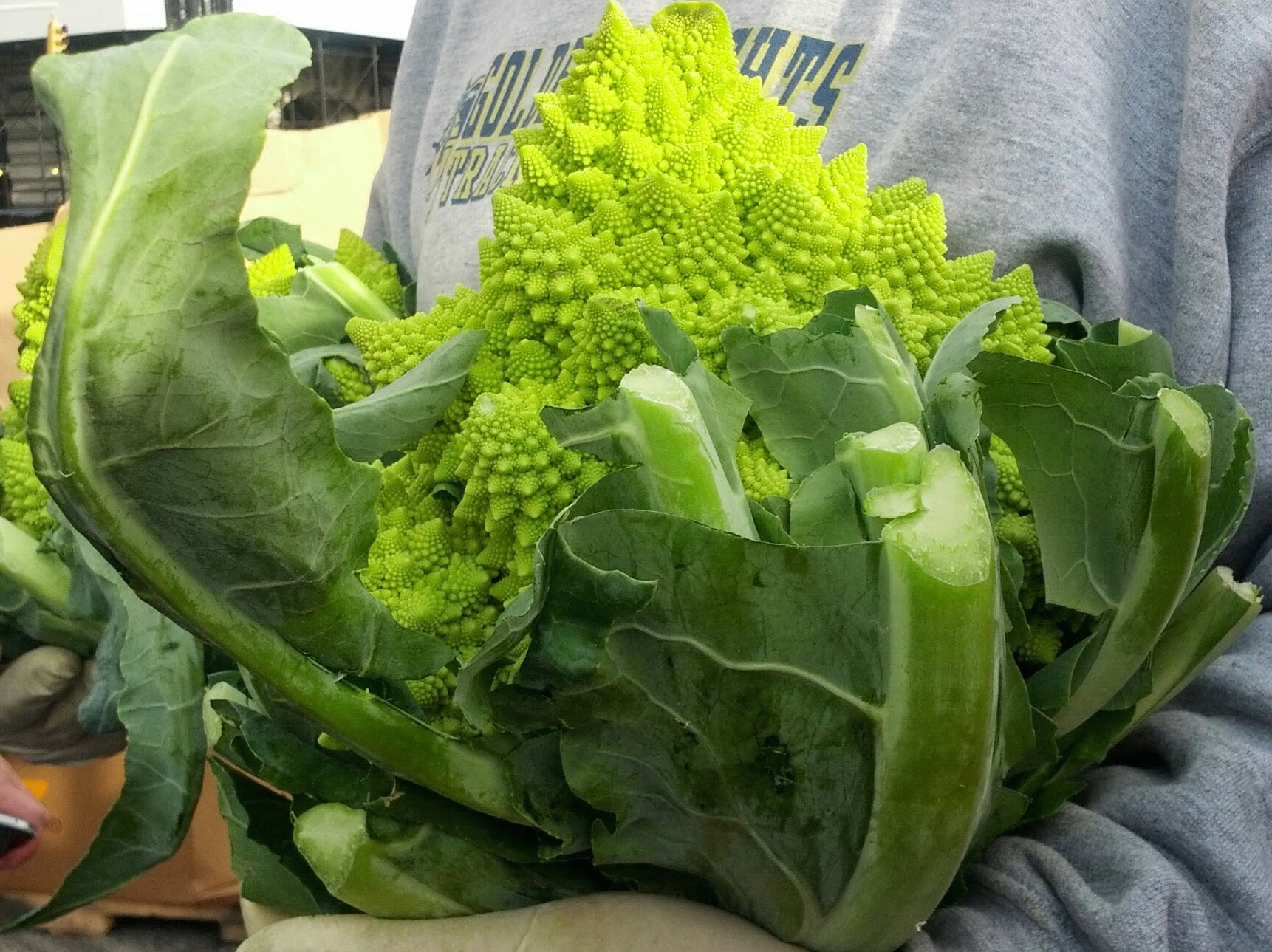
(Photo of Romanesco broccoli, Union Square Market, November 2014)

3Dec

Get Involved: MicroMappers Coconut Expedition

What are you doing this weekend? What if you could spend 5 minutes, 30 minutes or an 1 hour on a Digital Humanitarian Project? As noted before, it is one of my life goals is to build spaces and community activities to inspire people to get involved in their world. As my colleague, Patrick Meier, wrote – How can we get to the next million people. It is up to organizations and communities to make it easy for you to fit these small Tasks into your busy lives. This is why I am excited to collaborate on the MicroMappers Coconut Expedition. Our collective contribution will be used to assess food security in post-disaster zones. Time well spent.

On December 5 – 7, 2014 MicroMappers from around the world will participate on the Coconut Expedition. Join us.

MM coconut screen

About the Coconut Expedition

The SkyEye Project (based in the Philippines) used Unmanned Aerial Vehicles (UAV) technology to take 1000s of digital photos. The Qatar Computing Research Institute processed these images, then inserted them into our MicroMapper tool: AerialClicker. MicroMapper tools enable digital humanitarians to interact with text or images. MicroMappers (that’s you!) make decisions about the content. In this case, you will draw or trace lines indicating healthy and damaged trees. Each image will be reviewed by at least 5 different MicroMappers. All the data will be tabulated and given to researchers at Simon Fraser University Computing. This team will create an algorithm to assess damaged coconut trees. In the future, this type of machine computing could be used to assess damage in post-disaster zones. We will also share results with you over on the MicroMappers blog.

Coconuts are the “tree of life” and a key part of the Philippines’ economy. Discover all the ways that these trees are used:

coconut uses infographic

How am I involved?

I am delighted to officially join the Qatar Computing Research Institute, Social Innovation Team to support projects like MicroMappers. You can join this MicroMappers project simply be joining our mailing list and waiting for instructions on December 5, 2014.

See you there!

6Nov

Crisismappers Pre-Conference Training 2014

Crisismappers are converging in New York City this week for the 6th Annual International Conference of CrisisMapping. The term “crisismapping” is fairly loose as the global community includes diversity in maps, data informatics, humanitarian technology and research. We are a collective of people who use maps, data and technology for humanitarian aid and international development. This year’s theme is: Affected Communities in the Spotlight.

More about ICCM

ICCM continues throughout the weekend. The main event is Friday, November 7, 2014 with keynotes and ignite talks. This will be livestreamed so that you can watch along from home or offices. Join the Crisismappers community to learn and build with us.

#iccmnyc

Follow us on the live stream: bit.ly/iccmnyclive

The ICCM 2014 Agenda

ICCM 2014

As the ICCM pre-conference training and field trips organizer is it my goal to unite the different disciplines in unique zones to build, learn and share. Our training offering is a community driven effort with 3 tracks: Maps, Knowledge and Mobile/Hardware. Sessions are ongoing all day today.

About Crisismappers:

The International Network of Crisis Mappers (Crisis Mappers Net) is the largest and most active international community of experts, practitioners, policymakers, technologists, researchers, journalists, scholars, hackers and skilled volunteers engaged at the intersection of humanitarian crises, new technology, crowd-sourcing, and crisis mapping. The Crisis Mappers Network was launched at the first International Conference on Crisis Mapping (ICCM) in 2009. As the world’s premier humanitarian technology forum, we engage 7,000+ members in over 160 countries, who are affiliated with over 3,000 different institutions, including more than 400 universities, 50 United Nations agencies & projects, first responders operating in both the civilian and military space, dozens of leading technology companies, several volunteer & technical community networks and global, national, and local humanitarian and disaster response and recovery organizations.

Pre-conference Training

The Maps track including many diverse map software organizations and communities. Sessions include Google (Christiaan Adams), CartoDB (Andy Eschbacher), Mapbox (Matthew Irwin, Aaron Lidman), Ushahidi (Sara-Jayne Terp), HOT/OSM/American Red Cross (Chris Daley, Dale Kunce) and ProPublica (Brian Jacobs sharinig about remote sensing verification).

Research/Knowledge: What is the impact of Crisismapping? What are some ways to monitor and evaluate projects? Which ethical scenarios do we encounter? How can design of a map or data collection tool change the data? Can we use human centered design? What is the current state of research in crisismapping?

There are two sessions in this ½ day Research/Knowlegde track:

1. Open Data for Resilience Initiative (OpenDRI) (John Crowley)
Natural hazards with low frequency can lurk in history’s invisible depths. How do we use open data to help affected communities to map and see these risks? How can open data help governments and donors invest in building resilience in the areas which have the highest impact for affected communities? Learn the tools that the World Bank’s Global Facility for Disaster Reduction and Recovery has built to use Open Data to drive Resilience.

2. Education project in Guatemala tracking mapping needs. (Colette Mazzucelli, NYU) introduces the Pre-Training Session. Kyle Matthews, Senior Deputy Director, Will to Intervene Project, Montreal Institute for Genocide and Human Rights Studies (MIGS), Concordia
University will begin the conversation. Kyle will introduce the Digital Mass Atrocity Prevention (DMAP) Lab at Concordia University as well as the ways in which MIGS Professional Training Programmes on the Prevention of Mass Atrocities have integrated analyses of mapping
technology projects. Cristian Silva, Director, IFIFT, will highlight our experiences in Guatemala participating in the Multidisciplinary Field School: Forensic Investigations. We will then respond to questions from those in attendance. This will be followed by a brainstorming session with NYU GIS Librarian Andrew Battista and NYU Senior Technology Specialist Him Mistry coordinated by Colette Mazzucelli and the ICCM 2014 Team.


Mobile and Hardware

Mobile and Hardware (eg. mobile apps, Google Glass, imagery, satellites, drones etc) are incorporated into many crisismapping projects. Crisismappers are exploring new technologies to collect data and map in the field. This session will highlight tools and techniques.

The following workshops will be provided:

Integrating inclusive technology (Valerie Oliphant, Social Impact Lab)
This workshop will explore the idea of inclusive technologies. What makes a particular technology accessible in a certain place and time? How can implementers assess their operating environment to choose technologies, channels and tools that best fit their needs?

We’ll be looking at how to determine the accessibility and usability of different initiatives for different projects and contexts. Do people own or have access to mobile phones? Do they use SMS? Which mobile networks have coverage? How can SMS empower community workers? We’ll also cover how to map out your project in a simple way that exposes risks and incentives.

PUNYA (Lalana Kagal, Fu-ming Shih, Andrew McKinney and Evan Patton MIT))
We have been working for the last two years in a system that allows anyone to quickly prototype and build mobile applications for crisis mapping and other humanitarian ends. The project name is PUNYA (http://air.csail.mit.edu/punya/), and it is completely free and open source.

Geothings
(Kuo-Yu (Slayer) Chuang)
This session will be discussing and testing disaster responding scenarios with ICT tools (SMS).

http://geothings.tw/


Reality Check on Mobile Health
(Michelle Hamilton-Page (Ushahidi))
In this workshop we will look at some examples of how health promotion is leveraging mobile – including near field communication, SMS and smartphone apps – to work with communities to build relevant, iterative tools for health. Let’s crowd-source some successes and failures in health and mobile tech and check in with where things are going from the local to the global context.

http://www.ushahidi.com/

ICCM Field Trips

From Balloon Mapping to oil testing kits, Public Lab is leading the way with environmental data collection. How can we have the earth talk to us and how can we collect environmental information around the world? We can build our own sensors and stitch our own maps. This workshop will teach you the skills in an urban setting.


Neighbourhood Resilience Field trip with Green Map: Hurricane Sandy Zone
(Wendy Brawer)
Occupy Sandy and local communities built placemaking and infrastructure to communicate and support a community in need. Emergency managers are building programmes to make the region more resilient. How can crisismappers learn from this field experience?

http://www.greenmap.org/greenhouse/en/home


Office of Emergency Management - City of New York
(Jim McConnell)New York City has one of the largest urban emergency ops centers. In this field trip, you will learn about their work and how they use crisismapping techniques.

Thank you to all the organizers, sponsors, participants and especially the Black Box Communications team for making this a success.

18Sep

Infusing Ethics into Data Projects

Education, assistance and enforcement are needed to build better, ethically balanced data-driven projects. The Ethics of Data workshop on the Data lifecycle discussed ethical scenarios and key aspects of a data-driven project. This lead to many sticky notes and attempts to create the big asks and some outputs. The participants came from many different disciplines, which helped us quality check and inform our review.

Our group together created 3 asks for further review:

  • Resources: This should be a center online for people and NGOs to share and find guides on building ethical data driven projects.
  • Tool/Template: There should be a data risk/benefits/costs template as part of every grant application to build better ethical projects from front to back.
  • Review: Could there be a non-profit assistance group that provides free, consultation on ethical questions? How would they enforce standards? Could it be like a review board for research projects?
  • Milestones for an Ethical Data Project:

    We created over 100 ideas and grouped them into categories as milestones. There should be checklists for each milestone including key questions for the team. While the EoD team started on the mini-ethical checklists, this really needs more iteration. We also highlighted some milestones that are often overlooked or underfunded such as: a data collection checklist, pilot, quality control, verification, documentation, secondary use and impact/monitoring & evaluation. One other observation in our conversations was proper project management skills to scope many of the ethical minefields in advance of the project pilot.

    Key milestones on the Data Drive project

    *****
    Without trying to influence the room, the key project milestones resemble the toolkits we created at Ushahidi. Toolkits, including the Ushahidi one, do need to include more ethical statements/checklists to improve the success of building better projects. But, toolkits are only as useful as those who use and enforce them.

    Infuse with Ethical Checklists

    We gifted the Responsible Data Forum with a list of 70 questions, terms and ideas for the key milestones. If all the various milestones of a data-driven project are infused with ethical questions, checklists, and recommendations, this resource would be incredibly useful. Participants suggested that the checklists start with very generic items, but be broken out into topical domain recommendations/checklist items. This is to ensure adoption and remix in diverse fields from human rights to health to science. Some of the questions that really drove conversations included:
    Data analysis: What do you do when your data analysis provides negative results (from your hypothesis)? Quality Control: Can the data be re-identified? Resourcing: Who can collect the data and why? Secondary data: What is the time horizon on the data and future use criteria?

    Key Questions from the Ethical Checklist

    Ethics of Data – Resource Center / Review Board:

    One of the outputs of our first day of brainstorming was the need to have an Ethical Resource and Review Board. The team split off to debate the pros and cons of this idea. They even determined some of the needed services such as legal referral.
    Ethics of Data Review board

    More resources:

    The EofD team recreated a list of additional Ethics reading. It might keep you up all night with worry, but better to be ‘in the know’.

    As well, here is a compilation on Domain-­specific digital ethics, practices, and conventions. The one that really opened my mind was the Bellagio Framework: “Big Data, Communities and Ethical Resilience: A Framework for Action.” They provided criteria to consider: Governance, Place, Socio-Cultural Context, Science, and Technology.

    Thank you

    Thanks to our hosts at Stanford Center for Philanthropy and Civil Society (Kim Meredith, Lucy Bernholz, Rob Reich and Sam Spiewak) for making the Ethics of Data event possible. Thanks to my co-host Patrick Vinck of Harvard Humanitarian Initiative for great conversations. As always, Aspiration (Gunner and Misty) supported us with facilitation that inspired a collaborative and productive event for all. And, lastly, thank you to all the participants for being so thoughtful and inspiring teachers as we all trundle down this journey to bring better decision-making to all of our work.

    (Note: It is my hope that we can infuse HOT with some of this work and trial some ideas in our work. I’ll be sharing it with my fellow Board members and the HOT Community.)

15Sep

Data Cycling: From Choices to Consent

Stanford University has convened the Ethics of Data conference this week bringing leaders from industry, humanitarian, research and civil society together to discuss and build plans for data ethics in all our work. I’m participating by co-leading a workshop on the redefining the Data Lifecycle with my colleague, Patrick Vinck of Harvard Humanitarian Initiative.

Humanitarian OpenStreetMap Team

The Humanitarian OpenStreetMap Team and the wider Crisismappers community are discussing and using drones and satellites to capture imagery of land changes, displaced camps and post-disaster areas. Some of the topics we are discussing within these communities include how to include local NGOs and the government. In times of crisis, humanitarians and technologists are moving very fast. We need to have more guidance, research and best practices. At the Ethics of Data event, we will use HOT as an example data project in our conversations.

The HOT community is incredibly committed to helping humanitarians and affected communities with maps. We are frequency discussing how and what types of aerial imagery be shared. What kind of training do we provide for review and use of aerial imagery? What happens to the data after the emergency? What kind of ethical code should we provide for all Digital Humanitarians? As HOT builds Open Aerial Map and groups like the UAViators come to existence, we need to consider data education and use beyond text and include video, photos and drone/satellite imagery. In the US, Mapbox is educating use of drones by creating a map of where not to fly. This work is moving faster than the research. It is my hope from the Ethics of Data event that I will be able to convene conversations within HOT to determine our next steps. Keeping in mind that every humanitarian situation is different as are the jurisdictions in which global, local and remote contributors participate.

What about the Data Pipeline?

Data Storytelling via Infogr.am

Data Storytelling Lifecycle via Infogr.am

All around the world journalists, civil society groups and governments are working on open data projects. HOT is just one of many projects aimed at using open data to affect change. Determining the new data pipeline could be informed by HOT’s experiences. In the past year, I have been at countless events where people talk about the importance of open data, the importance of the data pipeline and the impact of data storytelling. I also believe that data needs to be open, when appropriate. But, I am wary about preaching about open data without including a clear ethical compass. One of the main reasons that data is not open is that people do not trust how the data will be used. And, frankly, it is very unclear what constitutes a clean dataset. Over the past years, I have worked with Geeks without Bounds, Ushahidi and Data Science for Social Good to try and solve this challenge with checklists or tools. Every dataset begets new questions. All of our work needs to be infused with questions about data accuracy and data ethics. It is misplaced as an afterthought.

Processing the Data Pipeline

This is a Data pipeline via OKFN:
Data processing pipeline (OKFN)

We need to create communities and tools with the data ethics checklists embedded into every aspect of projects from inception to funding to creation to education to analysis and to impact assessments. I’m truly looking forward to rethinking data project lifecycles and sharing the outputs with various communities to discover and remix together.

How would you rebuild the Data Lifecycle?

(Thanks to Nika Aleksejeva from Infogr.am for the Data Storytelling diagram.)

14Jul

Ok go! What are you doing at OKfest14?

Ok go! This week 1000 people converge in Berlin for Okfestival with many more participating and observing online. We are here to instigate open action and open minds.

The Open Knowledge Festival 2014 will be our biggest open data and open knowledge event to date. It will be global, inclusive and participatory. We expect it to create a significant local and international surge of innovation.

Throughout the festival, I will be leading the Community storytelling team. I’ll mostly be using twitter and storify to curate stories. Also, expect pictures and maybe some videos with attendees. During this event, I am also running or assisting on a large number of sessions and side events, plus attending some key sessions.

okfest logo

Here’s my schedule for the following week. See some of you soon! And, for friends who aren’t here, see you online (all items are at the OKFEST venue unless stated otherwise):

Sunday, July 13th (completed)

Watch Germany win world cup, walk to celebration at Brandenburg Gate (checkmark)

Monday, July 14th (completed)

Hold informal #geobeers with mapper and activist friends in Berlin at Strandbar (so amazing, done-so)

OKfest Opening Day: Tuesday, July 15th
Open Knowledge Community Summit (13:00 – 16:00 CET)

stickies are love

This is a community-driven event to talk about the Open Knowledge community. See all the details. I’ll be hosting a sub-group to talk about the last 5 months of community programming and get input into the next steps.

Storytelling team meeting (17:00 CET)

Sharing stories, ideas and moments is such a big part of community events. I’ve had much practice curating and encouraging stories at large events. Join our Storytelling team and meet other digital curators. Look for folks with blue ribbons or tweet us at #okstory with blog links, videos, photos, headlines and key themes.

How to join: Review our Storytelling wiki page, add your name to our etherpad, tweet @heatherleson or with #okstory to meet team members. Our first meeting is at 5pm in the Media Hub room at the Okfest venue. We will have other informal meetings to be announced throughout the event. Stay tuned.

School of Data Table at the open night (18:00 – 21:00 CET)

Come meet the School of Data existing and new fellows, local partners and team. Ask questions, get involved.

Community Drinks (21:30 – on)

The Community team is hosting an informal drinks night. Join us for chats and connecting.
Location: Prater Garten

Bike by

OkFest First day: Wednesday, July 16th

Storytelling Team meeting like at 8:30am at venue. TBD, see #okstory.

Sessions:
I’ll be attending all the morning sessions. Truly, super excited for Ory to talk plus graffiti activists!!

Open Coalition (12:00 – 13:00)

Help us build an Open Coalition across various open organizations and individuals. We have common missions and are stronger together.

Power, Politics, Inclusion and voice


“Data, information, knowledge is created in a political environment where power dynamics dictate who is/is not included in the creation process. Unless we consider who is involved in knowledge construction we run the risk of simply entrenching existing power structures. If open data is dominated by data produced in the Global North what chance do we have in redressing the balance of power for an equitable world? “

Humanitarian OpenStreetMap Team Workshop (16:30 -17:30 CET)

Humanitarian OpenStreetMap team will share stories and do a demo with hands on support. Super excited to support Katie and other Hotties on this.

Open Mapping Party

Join the Humanitarian OpenStreetMap Team, CartoDB, Development Seed, Zeit Online and Mapbox to talk open mapping strategies and tools over drinks. Heather Leson, Ian Schuler, Javier de la Torre, Alex Barth and Paul Blickle are in town and ready to connect over humanitarian response, data visualizations, OpenStreetMap and satellite imagery. We are inviting map nerds, enthusiasts and friends to join us for a mapper night. Sign up here.

survey tape for teams

Okfest Second day: Thursday, July 17th
Storytelling team – meeting tbd

Day 3 of Community Storytelling. Stay tuned for more highlights and a meeting

Crisis.net (12:00 – 13:00)

Crisis.net is a new open tool from the amazing Ushahidi folks. The team will share a demo and answer questions. I’m expecting many civil society and journalists to join in the conversations. Session details.

Low Tech Data : Storytelling and Storyfinding (14:00 – 15:00)

Rahul and Gabi will be a fantastic hosts for this session at the heart of every impact for civil society and activists. See more details:

Looking for creative ways to find and present data stories in low-tech settings? We will share our hands-on, participatory techniques for bringing people together around data to find and tell powerful stories without computers. You’ll walk away with skills and ideas to help the communities you work with!

Working with data can empower or disempower. Algorithms, technical language, unfamiliar processes – these all leave many communities incapable of working with data, or understanding data-driven discussions. Most folks don’t “speak data”.

How to Teach Open Data (15:30 – 16:30)

Join the School of Data and friends to learn best practices in teaching open data. (full details) We’ll have a world cafe to share

  • How to organise tech and data workshops
  • Building effective curriculum and accreditation
  • Type of education activities: a blended offline, online
  • Designing passion driven communities (I’ll be with Bekka from P2PU)
If I had more time or a time machine, I would attend these amazing sessions too!

School of Data

School of Data Summer Camp (Potsdam) (invite only): Friday, July 18, 2014 – Monday July 21, 2014

School of Data is the division that I work in at Open Knowledge. This summer camp includes fellows, partners and local instances of School of Data. We will talk about strategies, share skills and develop plans for the upcoming year. I am specifically sharing community programming and community engagement best practices:

July 22nd, 2014

FALL OVER, Report back, sleep!!!

15Jun

Batman, Foodies, Fashion + CrisisMaps at Next Day Better

Building a common good unites us. This Thursday I’m participating in Next Day Better in Toronto. This is such a special event combining fun, food, art and technology to inspire people to make the Next Day Better. I’ll share the story of Crisismappers highlighting the Humanitarian OpenStreetMap Team response in the Philippines.

How will I make the Next Day Better?

I help people get more involved in their world. One example is supporting an open community-driven digital humanitarian response.

“We are a culture platform that builds and activates diaspora communities to create a better future. We believe that diasporas like the Philippines global community are hubs and inspirations for social innovation, incredible design, and world changing ideas. We bring these doers and change makers together to share their stories and make the next day better.”

nextdaybetter

Tickets are only $20.00 with amazing talks and food! Please join us.

Help Share about Next Day Better

Facebook updates:

We’re partnering with social innovation group @NextDayBetter to celebrate their launch in Toronto on June 19. It will be a night of inspired talks from changemakers – the #Philippines is ready for open-source mapping! If you’re in Toronto, RSVP here.

Amazing things are happening June 19 – board member/idea hacker Heather Leson will be @NextDayBetter’s launch in Toronto as they bring big-idea thinkers, amazing work doers and changemakers together. Get your tickets here.

Tweets:

We’re partnering w/ @NextDayBetter for their launch in #Toronto 6/19! Learn more: http://www.bit.ly/NextDayBetterTOR

The #Philippines is ready. Join us @NextDayBetter Toronto launch | 6/19 7pm | RSVP http://www.bit.ly/NextDayBetterTOR

About NextDayBetter

NextDayBetter is a platform that spreads ideas and actions that make the next day better. Ideas and actions are Philippines-flavored and rooted in design, entrepreneurship and innovation.

We invite innovators entrepreneurs, designers, do gooders — both Filipino and Non-Filipino—to share their stories about creating a better future.

Visit www.nextdaybetter.com for more information.

I found out about the Next Day Better group after engaging with folks around Hacking PH: focused on rebuilding a resilient Philippines. They really inspired me with their approach to building community locally and globally.

How will you make the Next Day Better?

14Jun

DISPATCH: HOT @ IEEE Humanitarian Technology Conference

[Cross-post from the Humanitarian OpenStreetMap Team blog]

A few weeks ago the Humanitarian OpenStreetMap Team was a guest of the 2014 IEEE Canada International Humanitarian Technology Conference (IHTC). In the session, Samual Paul Alce, Pierre Beland and I each presented about to share all about the community, activations and how to use OpenStreetmap. It was an honour to participate and share the HOT story with such an important organization. It is our goal to build relationships with groups like IEEE to improve processes and technical implementation. We would like to thank Alfredo Herrara, Glenn McKnight and the whole IEEE IHTC team for inviting us. It was a pleasure to host this session with my guests: Pierre and Samuel. Here is the abstract and our slides with speaker’s notes:

Abstract

Since the Haiti earthquake in 2010, new partners support the UN Agencies and International organizations through the Web 2.0 or Collaborative Web. OpenStreetMap is one of these community of volunteers. It has shown on several occasions its ability to mobilize hundreds of contributors and support remotely, providing maps and services necessary for such actions. The Humanitarian OpenStreetMap Team (HOT) makes the bridge with the humanitarian organizations.

In this session, we will discuss open source methods for humanitarian technology. The workshop will include an overview of Humanitarian OpenStreetMap Team’s (HOT) activities, some of the tools and best practices. We will include stories of activations around the world from Indonesia to Haiti to Philippines and the DRC. Our session also includes hands on training from HOT community leaders. Join us and learn about new methods in digital and in-person responders using OpenStreetMap.

12May

May Days are here!

School of Data

May is big month for events on all things open and technology. I’m participating in a number of events wearing a number of hats: School of Data, Humanitarian OpenStreetMap Team and the Crisismappers Network. Most of these are in Toronto and some are free. Hope to see you there!

GO Open Data (May 15, 2014)
What an honour it is to participate again in the 2nd annual Go Open Data event. This year I will be keynoting about Challenges and Next Steps for Open Data. Rest assured I’ll give some global and local examples from python scraping to feelings. There are some spots still open for the event. Hope you can join it! (There is a $25.00 cost.)

ICT4D Toronto Drinks (May 20, 2014)
Having attended ICT4D drinks in London (UK) and Washington (DC), I know in advance the mix of great folks. I’d like to see this as a regular event in Toronto. This is a free night to talk with like minds using Tech for Good around the world. Register here!

1st Toronto Tech Salon: How Can Technology Improve International Development? (May 21, 2014)
Tech Salons are a way to have a deeper discussion about topics. The model is much more interactive. One of the questions that is sure to stir up some great debates:
“And are we actually imposing Western values and suppressing local businesses with extractive electronic tools no better than colonial powers of the past?”

This is an invite-only event, but I think there are spots still open. I love that some of the participants are focused on mobile and development. To register, click here.

Subtle Technologies (May 24, 2014)
I’ll be joining Stephen Kovats’ Subtle Technology session: Critical State Making: Applying Open Culture in Post-Conflict Development. Crisismappers and the Humanitarian OpenStreetMap team are using open technology to support humanitarian efforts. Using some of the recent examples from Sudan, Mali, and Guinea, we will talk about the complexities of building capacity with local leaders, local context and local language. It is always a delicate balance. (This

MESH – Open Data Brainstorming Workshop (May 27, 2014)
At MESH, I will be co-hosting an interactive session about Civic Tech and Open Data at MESH. We will be stirring up conversations and creating a snapshot of what MESHies think about Open Data and Civic Tech.
(There is a cost to register for this event.)

IEEE: International Humanitarian Technology Conference (June 1, 2014)
With fellow Hotties (community members of Humanitarian OpenStreetMap Team), we will be hosting a HOT workshop all about how technology and HOT’s processes have had an impact. We will give a walk-through about recent HOT activities including the Philippines response as well as do some hands-on mapping to show some of the technology we use. Our goal is to better connect with the IEEE community of expertise. (This is a paid event in Montreal.)

Truly it is a pleasure to have a full month of sharing and making by hosting, keynoting or participating in all these activities. Now, off to prepare. See some of you soon.

(Photo: School of Data expedition in Geneva (September 2013))

20Apr

When Birds of a Feather Map Together

[Cross-post from Humanitarian OpenStreetMap team blog.]

All spring we’ve been thinking about how to grow and support the HOT community. We know that we need to improve support to keep up the momentum of the last year while balancing quality great work around the world. At the State of the Map US event, we held a HOT BoF (Birds of Feather) session with over 45 participants. It is a small section of the wider global community, but it gave us a chance to see old friends, meet with partners and potentially engage new mappers.

Our conversations touched on recent activations, how to get involved, types of community members, teaching tools/methods, partnership engagement, working with imagery providers and, of course, UAVs.

How to Get Involved:

  1. Join OSM, visit LearnOSM.org, watch MapGive videos
  2. Join HOT mailing list, IRC
  3. Pick a Task from Task Manager.

HOT’s community is gearing up. We have been doing some deep tissue analysis on how to improve in our HOT community Sprint.  We recognize that there several distinct groups within our community who have particular needs that are unique to that group. These core types include connectors/teachers/organizers, mappers (many types), partners/mission supporters, techies, and, lastly, those involved in the business of mapping/data consumers/supporters.

map head

Activations

HOT has been activated many times in the past year with the largest activation Typhoon Haiyan (Philippines). The wider community works with official and unofficial partners to respond such as the American Red Cross, Medecins Sans Frontieres, USAID, HIU, CartONG, and the World Bank’s Global Facility for Disaster Risk Reduction and Recovery. Some session feedback included that HOT needs to get better with a structured owners and workflows for contact while capturing the partners needs. 

To improve the quality of data, we need better activation specific training to help compare before and after imagery sets, plus local context guidance.  One participant advised that they would like iD (the main editing tool at OpenStreetMap.org) with a swipe function to see the before and after imagery. For remote mapping, there needs to be more training tools to help improve the first edit. But, there needs to be a validation process. While it might be time-consuming, it might be beneficial to have a Tier 1 – 4 process to improve quality checks and provide mentorship. Mentorship is actually already happening, but this would allow us to formally recognize leaders more. Map Roulette might provide a way forward on this to be able to pull out the data that needs a second or third review.

UAVs

From imagery to drones, trying to solve the equation of how to get quality and as close to real-time data was very much on our minds. HOT has received some UAV imagery but has much caution in getting involved in UAV data collection as… there are problems with getting clearance for airspace, and technical work to patch together a mosaic for tracing. Add to this the complexities of liability issues and the risk to volunteers on the ground who could be accused of espionage (as has happened to other humanitarian volunteers). The level of resolution is an issue. We are currently looking at buildings and infrastructure – but there’s a lot more to look at that have : what if UVA derived detailed imagery was made available? What scenes would be made public to all parties? Who would be making vulnerable? What about all the privacy and security issues? What about the safety of the vulnerable should a drone be tampered with or crash.

The Sexy, Unsexy stuff

In terms of documentation, just like the wider Humanitarian field, HOT needs to build a research environment to create case studies from end to end. These need to include items like how to make something repeatable. HOT also needs a research arm to help tell the stories and analyze the progress to help guide any changes.  

HOT needs are project managers for the tools and products that we produce within the community. All of our products needs to be translated and up to date. These folks are most welcome to join the Technical Working Group. 

The Sexy, Unsexy stuff

In terms of documentation, just like the wider Humanitarian field, HOT needs to build a research environment to create case studies from end to end. These need to include items like how to make something repeatable. HOT also needs a research arm to help tell the stories and analyze the progress to help guide any changes.  

HOT needs are project managers for the tools and products that we produce within the community. All of our products needs to be translated and up to date. These folks are most welcome to join the Technical Working Group.  

Some of the unsexy things (thanks Robert Banick for coining it) that are needed are: documentation, policy, health and safety and more. Our friends and members from the Red Cross advised that we publish internships and volunteer roles on our website to a wider outreach. We have many mappers in our network, now it is time to grow the support areas.

Building Map Literacy, One Edit at a Time

One the other end, Map literacy is hard to do in an emergency. Proactive map projects like HOT Indonesia show that this type of knowledge sharing and capacity building is much more effective done in advance. The same methods apply for our Humanitarian organization partners.  As we working more pre-disaster, we’ll have better data about the risks – the balance of working on basemapping vs. damage assessment will shift and this will change the game.  

One day we’d like to have all the active community participants and Board members in the same room. Until then, we are very lucky to HOTties meet and share. HOT’s community is just a small corner of the wider OpenStreetMap community. We are fortunate to have opportunities to meet. Thanks to the HOT BoF participants and State of the Map US for giving us a place to connect.

Some Resources

Authors: Heather Leson and Mita Williams

Images are in the Public Domain via the Noun Project

© Copyright 2016, All Rights Reserved