crisis

24Jan

Planning for the Kenyan Elections

Nairobi, Kenya

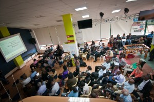
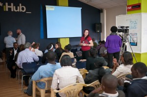
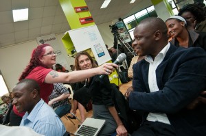
Since I arrived in Kenya at the beginning of January, I’ve been deep in Uchaguzi (Kenya Elections 2013) Planning. There has been deep dives in crisismapping strategy, local political ecosystem and, of course, many community events. It is a pleasure to host events bringing like minds together for a common purpose.

I’m blogging on the Ushahidi blog about the project.

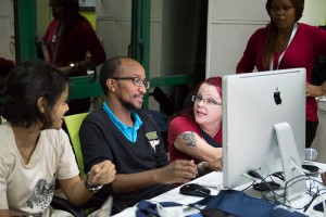
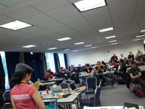
Uchaguzi Community Meetups


(Picture by Jonathan Kalan)


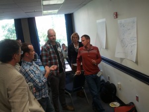
(Picture by Jonathan Kalan)

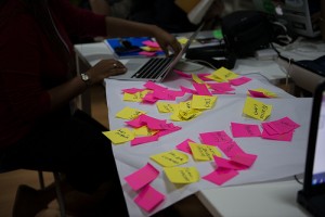
I organized a community map word exercise during the meetup. Kenyans described the regions of their country based on perceptions. It was great to get people interacting and thinking about location:


(Picture by Jonathan Kalan)


(Picture by Nekesa Were)


(Picture by Nekesa Were)


(Patrick Muniy created this infographic from the session)

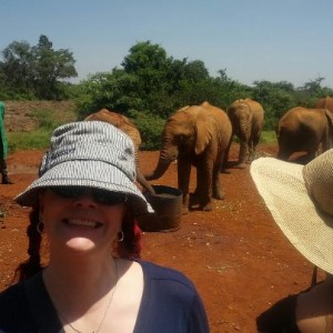
Also, I did take a break to visit the elephants:

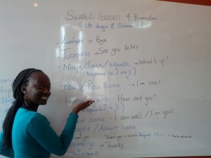
Swahili Lessons

4Jan

Coining Global and Hurricane Sandy

In December, I had the honour to present at the United Nations Spider meetings in Vienna. Here are those presentations with details notes:

Coining Global is a state of community for where Crisismapping and Digital Humanitarianism should grow:

Hurricane Sandy saw the rise of many Crisismapping projects, including the great Hot or Not test of satellite imagery. There was also a large number of Crowdmaps launched:

15Dec

HOT membership and Board proposal

The Humanitarian OpenStreetMap Team (HOT) is in election mode. I hope to become a member pending approval and am proposing to join the board. More on that in a bit.

Humanitarian OpenStreetMap Team

What is HOT and Why is it so important to the Digital Humanitarian Ecosystem

HOT grew with the need to recognize emergency and crisis mapping. Over the past almost 3 years, I’ve watched the team grow, I’ve worked on projects that benefited from HOT contributions and I’ve been continuously amazing by their talent and strengths.

More about HOT

Become HOT

The process: You need to be nominated to be a HOT team member. (This window is closed now)
Current Membership


You can still join the mailing list and contribute.

Their HOT Tasking tool is one of the best micro-tasking tools I’ve seen in digital volunteering. You can get started here.

HOT Board

In the coming week, HOT members will be voting for a new Board.

I am proposing to join the HOT Board pending acceptance as a HOT member.

Here are some of the things I can offer

1. Fundraising, Outreach and Storytelling skills.
2. Advocacy: While I may not be an active OSM contributor, but I am a big advocate of HOT and OSM in most of the work and volunteering I do.
3. Mapping organizations like Ushahidi need OSM to have the free imagery just as much as OSM wants it. I would essentially be an end-user in your corner.

In my job at Ushahidi, we changed our base map to OSM this year. When I talk with deployers, especially those working in crisis or conflict areas, they advise that they can’t use OSM as a base layer because the map is empty. One most recent example was planning for the .ke Elections in 2013. I want to join the HOT team and be an active more formal supporter to fill this gap. There has got to be ways to get imagery and to match the HOT team to these citizen science mappers. The map should not be a deterrent but a benefit in their journey to share stories of what they see and what they hear.

Thank you

29Nov

What kind of Internet do you want?

The Internet is our community garden, our public space and our workshop. Every day I work with people around the world who create maps and technology for good. A free and open Internet invites this collaboration beyond borders, religion, politics and societal barriers.

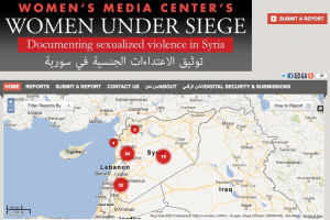
Crisismappers, particularly, conflict mappers do some of the bravest and scariest acts of Open Internet Activism. They take my breath away giving voice to the dispossessed, documenting atrocity and informing the world. Two such mapper groups are Syria Tracker and Women Under Siege Syria. Reports of a full communications shutdown in Syria takes away their voice. They should have the right to voice. We should protect their right to voice. What will the impact of this outage be on their important work?

Lauren Wolfe, Director of Women Under Siege, was interviewed a few months ago by the Canadian Broadcasting Corporation’s The Current (audio) about this project and their verification process.

Women Under Siege

****
The Syrian Internet shutdown was reported as I was writing this post about why the ITU and WCIT need to open their doors and not make decisions on behalf of the globe. More about this from the Mozilla andGoogle’s Take Action sites.

****

What kind of Internet do you want?

Webmakers

At Mozilla Festival, we remixed video with Mozilla Popcorn. You can Make your own ITU activism video. There is something magical about being able to remix our web and amplify our voices. Webmaking is the kind of Internet that #freeandopen encourages and supports. It is the type of community space that allows for more voices to be heard and to interact. Creating the web is supporting it to exist.

Security and the Internet

Today the CBC posted an article: “Should the UN Govern the Internet“. They interviewed Citizen Lab’s Ron Deibert about his thoughts:
“the recurring push at the ITU to wield more control over the web is part of a bigger trend “towards greater state control of cyberspace and an older internationally governed system of telecommunications.””

I’ve been much inspired by the work of Citizen Lab over the past year. They fight the good fight with data and analysis about security. And, they’ve provided Ushahidi and myself some valuable help as I work to guide people through various security questions with technology. We need to be very mindful about What kind of Internet we are accepting and what kind of Internet exists. Ron’s TEDxToronto talk should be mandatory for any activist and Internet user.

Voices of Access, Infrastructure

Internet access is a growing human right. Attending Annenberg-Oxford’s Media Policy Summer Institute gave me an opportunity to meet citizens from around the world who study, work or are activists for media policy. Learning first hand about walled gardens and the advocacy of this type of “Internet” provided much framing for what kind of Internet other people might want. It was a rich discussion which could use a deeper study. Why do people support a closed internet? Who are they?

Working and volunteering in a space of Internet and mobile activism for technology and maps for social good, I’ve collected a number of maps that range from sentiment and demand for access, infrastructure reports, power outages and even how SMS campaigns are being used for ICT4D. Each is a unique project, but they collectively show how we could potentially map voices/stories and use this data to analyze with layers of hard data. We need to find new ways to use our technical might to show where access is and provide the qualitative feedback for “why”.

Launching an global map for stories about access and benefits of a free and open Internet would be a mighty task needing more than a few strong people. Perhaps not this time without a little help from friends. With Random Hacks of Kindness this weekend, it might even be feasible to consider? The question is: How can a map unite our common cause for the Internet we want or, even, open a dialogue about the different versions of an Internet?


Example Maps about Access, Voice and Infrastructure

Bring SuperFast Broadband to Coventry, Solihull and Warwickshire (UK)
Reporting Mobile Coverage in Sweden
3G Fail in Brazil
SMS in action (Global)
Wimax Monitoring in Italy
Infrastructure issues after Hurricane Sandy (USA)
Powercuts (India)

****

(At Ushahidi, I write frequently about our community of deployers who give voice around the world during times of crisis, for elections, and for civil society topics varied from corruption to environmental movements to human rights to violence against women. )

14Nov

Anti-Corruption Fighting -15IACC

Anti-Corruption and Transparency activism is merging with hacks and maps. In the past year at Ushahidi, I’ve met a number of mappers who are using the open source tools to activate and organize around these topics.

As part of the 15th Annual International Anti-Corruption Conference in Brasilia, Brazil, I met these mappers and held an Online Tools Game Changers Session about their work. The Transparency Hackers movement in Brasil, lead by Daniela De Silva, held a simultaneous hackathon. Let no topic go unturned.


Here are some snippets on this work:

An Interview with the IACC team


An interview with BBC Brasil

“Por trás dessas ferramentas online que servem de “atalho” para se denunciar corrupção está uma multidão de jovens internautas.

“A juventude está mudando as táticas do ativismo anticorrupção. Eles trazem consigo um incrível entusiasmo por tecnologia móveis e novas mídias, como vídeos”, diz Heather Leson, uma das diretoras da Ushahidi, à BBC Brasil.

“Esses jovens ativistas agora atuam e compartilham, ininterruptamente, em suas redes sociais. E assim eles não precisam mais usar arquivos em PDF de 50 páginas para lutar contra a corrupção. Estão livres disso. ”

Some of the Corruption Mappers:

Heather

10Oct

Random Hacks at ICCM


[Cross-posted from Geeks Without Bounds. Co-written with Willow Brugh. Photos by Heather Leson]

The Random Hacks of Kindness at International Conference of Crisis Mappers took place this past weekend (October 13 – 14, 2012) at George Washington University in Washington, DC. Humanitarian hackathons are specialized in that the hacks proposed are brought by subject matter experts who fully understand the needs and impact of a tool built out during the event. While not all events curate their challenges, we did at this one, with the esteemed team comprised of The Doctor, Robbie Mackay, Jen Ziemke, Heather Leson, Kate Chapman and Willow Bl00. They examined each of the 16 proposed challenges for usefulness, if it could be accomplished over the weekend, technical specs and feasibility, as well as strong use case. Our 40 participants piled into our tiny room to work on the 7 of selected challenges. 5 presented on Sunday afternoon.

Rhok ICCM

Juhee from MIT Media Lab presenting Open IR

Many thanks to our sponsors AT&T Developer Program and John Carroll University. Thanks to you, we had essential coffee, delicious food, candy and steady internet tubes. We were also able to award prizes to each of the teams.

James with Amnesty International worked on Challenge #8: Geographic Web Data Curation Tool with Nico from InSTEDD. This collaboration made me happy for two main reasons – one was that they were able to address James’s challenge with an existing tool. The second reason is that James, who came with little coding experience, took the weekend to learn about RIff and apply it to his problem space. There is a distinct issue in the digital humanitarian community of “Wasn’t Built Here” which adds to the already massive cognitive load of the responders.Extending an existing tool means we can keep using what works while making it better.

Clay and Jorge (Challenge #13: Mapping United Nations Security Council Resolutions) implemented MapBox by porting in UN Policies and geocoding them to the areas they were based around, matching a geospatial and temporal interface to search the resolutions issued by the United Nations Security Council. A quick way to see where the UN had been focusing, along with an easy pull on the referenced documents, this creates another way for people to search and catalog.

The Taarifa team linked up to a group in England to create the hardware trigger for a data snapshot from just about any input, along with the API call which would link up to that snapshot. A continuing hack from H4D2 (and other hackathons), we were pleased as punch to see this group working hard to see their platform for civic reporting push forward and build out their contributing community.

A subtle but powerful glue was created by Josh Snider while working on Challenge 15: Extracting info into SMS reports. A user could send in a text which would port directly into a wiki and geocode. If formatted incorrectly, a text is returned to the person asking them to reformat. The potential of messaging format issues could assist in the accuracy of content collected to so support digital humanitarians in processing massive amounts of incoming texts into maps.

RHOK ICCM

HXL Team brainstorming with Andrew Turner, ESRI

Best overall hack went to the Humanitarian Markup Language (HXL) team, a challenge brought to the table by UN OCHA’s CJ Hendrix. It furthered the capabilities of this platform by doing creating an easy way to interact with maps, with special care payed to the visualization and interface – be still my linux-loving-mac-using heart. It eases the process of grabbing maps, uploading maps, and plugging them into what you need.Huge thanks again to our sponsors, and to the ICCM team Jen and Patrick for organizing the event our hackathon went hand-in-hand with. A special sparkle kittens to Heather Leson of Ushahidi for co-organizing and facilitating the event. I’ll match my blue hair to your pink hair anytime.

RHOK and ICCM share common goals of uniting the brightest minds for sprints of collaboration.

RHOK ICCM

Willow at ICCM RHOK

This was the first time that RHOK occurred at ICCM. It was amazing to have guest subject matter experts join the hackathon to share their expertise with the talented developers and challenge owners. This is a huge opportunity to keep the momentum. A number of the challenges will continue on to RHOK Global in December. Willow and Heather will work with the folks to mentor their efforts. As well, based on the success of ICCM RHOK, we recommend that ICCM in Nairobi also have a simultaneous RHOK.

4May

Map it, Change it! [video]

As much as I love talking about deployers, digital volunteers and mapping, I still get a bit nervous seeing videos of my talks. I was honoured to speak at TedxSilkRoad on April 11, 2012 in Istanbul, Turkey.

You can tell I was talking fast when “Non-government Organizations” suddenly got renamed “Non-Government Associations.” The presentation has 2961 views.

(Also see: Map it, Change it (blog post).)

4Mar

Speaking events: Mobile and Mapping

AMREF : Mobile Africa

I’m honoured to talk about the rise of Mobile and Ushahidi at this week’s AMREF coffee house on Wednesday, March 7, 2012:
AMREF logo
Mobile Africa: How Technology is Reshaping the Continent

AMREF’s Coffeehouse Speaker Series on global development. Join us at Urbana Coffee on the first Wednesday of every month at 6:00 pm.
Technology advancements are reshaping Africa politically, socially and economically. Join us to explore innovative technology solutions being used to make a lasting difference in people’s lives.

African Medical & Research Foundation (AMREF)

York University Symposium on the Tohoku Earthquake and Tsunami

The online response to the Japan earthquake was an incredible surge of volunteerism. I’ll present the story of Hal Seki of Sinsai.info and his team’s mapping experiences in response to the Tohoku Earthquake and Tsunami.

“The Japan’s Tohoku Earthquake and Tsunami of March 2011: LESSONS LEARNT”: March 9th, 2011, 9AM -5 PM

Organized by: Disaster and Emergency Management Program

20Feb

Do-more Disrupters: The People Behind the Stories

[Cross-posted from MediaShift: Idea Lab]


One spark and it happens: An individual or a team of people create a deployment using Ushahidi or Crowdmap. Their motivation and the inspiration are telling tales. These citizens, diaspora and a global community collaborate near and far to make change happen. Motivated often by the simple act of giving voice and building momentum for their ideas, most do so without payment.

Who are these deployers? One thing connects all of them irrespective of location or topic: They want to do more in their communities and world.

Ushahidi gives us a window into many varying disruptive movements, large or small: community members, from Syrian Tracker to Moroccan Elections Elections to Open Nuclear Iran mappers to Maps4aid.

Even children are trying to activate change outside the traditional methods or institutional structures: Amrita of Bangalore, India (8.5 years old) is a Trusted Food Reporter for the Cost of Chicken Project; kids from around the world are collecting data on local food conditions, from grade 8 students in San Francisco to grade 3 students in India; students are mapping to learn and collaborate about food production and food sustainability.


Olga Werby, Mapster and President of Pipspeak Productions.

Software Centre, the Morocco-based team led by Tarik Nesh-Nash, started with election monitoring with Marsad.ma and is now mapping corruption. Boyan Yurukov created the Bulgarian award-winning 2011 crime.bg. He also developed and installed Fairelections.eu election mapping, which was moderated by the Institute for Public Environment Development.

These deployments are aimed at giving voice to fair democratic practices. Each of these deployers mentor new mappers sharing best practices or create additional tools, like Boyan’s Facebook app. By sharing their story, they’re beginning to inspire others to map elections or corruption.

Why Storytelling Matters

Persistent outreach and storytelling are key to successful deployments. The Syria Tracker team is a collective of partnerships and volunteers, including some of our friends within the Crisismapping Network and the Standby Task Force. Over the past 286 days, they’ve mapped more than 6,300 deaths.

Melissa Elliot

Melissa Elliot, left, is the Reports Coordinator for the StandBy Task Force.

Shemeer Babu is one mapper in India focused on highlighting the issue of violence against women with Maps4Aid. His next project is building out Blogs4Aid. His plan will be focused on using SMS (short message service) and maybe IVR (interactive voice response) since 90% of rural women in India don’t have smartphones. Both @maps4aid and @syriatracker use Twitter on a daily basis to keep their map story alive and in the minds of their followers, using free online resources to augment their story.

Melissa Elliot is a core team member and reports coordinator of the StandBy Task Force. This week she attended a Canadian government event to share the story of Crisismapping and volunteers. Her constant drive to make a difference in the world inspired officials to consider their first-ever Crisismapping Simulation. As a leader in a growing community that often uses Ushahidi, she is one of over 750 volunteers who map information for emergencies.

We’re delighted that these talented volunteers often assist other Ushahidi community members with their non-crisis related maps.

How can you help?

Every day deployers need support to build their projects. For example, Open Nuclear Iran needs a banner for its Crowdmap; Shemeer needs a hand determining how to grow his local project to a larger sustainable Blogs4Aid initiative; the Corruption Tracker and the Harassmap teams are looking for more volunteers to support their long-term projects.

Requests for assistance can include help with storytelling, project management, technical assistance, design customization and security concerns.

These people often use Ushahidi’s software in their spare time with no to low funding. They are the so-called “do-more disrupters.” Mentoring and help matchmaking are core to these deployers’ ongoing efforts.

We’re launching a new wiki space to assist our existing Community Connect with people who may be able to help. To find out more about this, join our community site or follow our Ushahidi blog. Who knows how you will inspire and be inspired to actively do more in your community and the world!

15Jan

RHoK follow-up: Population Centers in Disaster

At Random Hacks of Kindness 2.0 (December 2010), volunteers from CrisisCamp TO, RHoK Seattle, Humanity Road, Sahana and OpenStreetMap joined to work on a project called: Populations Centers in Disaster. Each of our groups continue to commit time and knowledge to complete this project.

Three days after the devastating quake struck Haiti, the towns of Jacmel and Leogane were still isolated — no communication or transportation — though we knew people were there: 128,000 in Leogane and 40,000 in Jacmel. A data query tool that identifies high concentrations of population may help volunteer technology communities with their communication efforts. A lack of communication inside a population zone points to a problem and the query tools being developed may help speed up and improve volunteer contributions to situational awareness.

@Redcrossmom @CNN I know you have lots of crew on the ground in PAP but very little news is coming from outside of PAP – Jacmel & Leogane need help. (Twitter, January 15, 2010).

Situational Awareness

At the onset of a disaster, time lost means lives lost. As virtual volunteers, Humanity Road’s first response step is to identify affected hospitals. In an event that impacts a large geographic area, we need to quickly triage the situation and determine which population centers are affected. Part of this decision process involves identifying areas of population concentrations. For this, we have been turning first to Wikipedia to identify and understand the local area. Using this approach to search for information is manual, time intensive and requires multiple keystrokes of the same type of information. Manual research of standard information means time lost and that equates to lives lost. We look for cities within range of the epicenter of the earthquake or event, populations of those cities, hospitals within the impacted area, GPS coordinates, and local government structures for towns, counties and districts. Sometimes the absence of news does not indicate the absence of need.
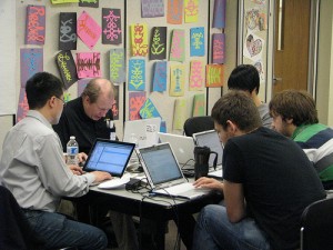
RHoK

(RHoK Toronto, December 4, 2010. Photo by Cynthiagould.com)

The Project

We need a tool that would allow us to extract from Wikipedia into a Google Doc – the population centers for a defined area – such as City, District, Country. This would improve our volunteer response time. Humanity Road has previously worked with Sahana, Google, Gisli Olafsson and others to determine project needs.

The RHoK problem descriptions submitted included an outline for a query tool that would return the population centers within a boundary. The bonus tool would return results of hospitals in an impacted area, including contact information and GPS.

The RhoK Toronto team focused on the Hospital solution, while the Seattle team focused on the Population centers solution. The teams collected the data into Google fusion tables. By the end of the weekend, they had collected and stored a significant amount data that will help in future events.

The Next Steps

Data will reside within Sahana Eden, and be exported (Google Fusion Doc) for directed use by Humanity Road. Google Fusion Doc may have data limit parameters. The tool will help non-super users volunteering for Resource Management. Final product will reside on the Sahana database accompanied by the capability to extract specific hospital datasets.

The project needs presentation tools to help spontaneous volunteers work with the data. This includes criteria for data updates, to include the notes on impacts of infrastructure, operational impacts (damage, flood etc) of the hospitals query, developing the functional query for the populations center, and determining server space, and file formats for storing the data in open source format for all to access and use.

How you can Help:

1. Server space
2. DB specialist/developer to create query:finds objects (populations, host) within latitude and longitude radius. A query that finds “x” within radius of lat and long within the database
3. Support for a radius query to Sahana Eden

Our current project status:

1. Colin: talked with his Toronto – OSM folks about doing a OSM location hospital query
2. Heather/Cat/Pat: write a blog post and being outreach program
3. Terrance/Pat: will work on Sahana Eden component
4. Cat: will identify primary data fields
5. Colin/Pat/Terrance: share script
6. Pat: will start investigating the Final product- Sahana db, but with capability to have a hospital db can be pulled for a specifics.
7. Willow: Seattle team is on stand-by for the next steps.

We welcome any help you can provide. Contact: Heather (heather at textontechs dot com) or Cat (PeacefulIntent at humanityroad dot org)

Post by Cat Graham (Humanity Road) and Heather Leson (CrisisCampTO/RHoK TO)
© Copyright 2016, All Rights Reserved